Gentrification is not a new thing in North Omaha. The idea isn’t just about coffee shops and bike lanes either. Instead, it is the final act in a century-long drama focused on land speculation, state-sponsored disinvestment, and the systematic extraction of Black equity from the community. To understand how North Omaha is being “revitalized” right now, we must first understand how it was intentionally and strategically devalued for decades. This article is a chronicle of a city that has consistently viewed the area north of Dodge Street and east of 72nd Street as a flexible resource to be modified, severed, or erased whenever the city’s bottom line required it. This is a history of gentrification in North Omaha.
1. The Language of Gentrification

Omaha has a way of using words to make neighborhoods sound terrible before dismantling them. Throughout the 20th century the local media, politicians, city reports, capitalists, and planners have used all kinds of language to justify the neglecting North Omaha and seizing of land, homes, and the future of the community. These words transformed human communities into clinical problems requiring surgical intervention.
1.A. A Glossary for Gentrification in Omaha
This is what urban planners call “linguistic redlining.” This is a term that describes the use of language as a tool to create and enforce social, economic, and racial barriers and boundaries, often involving the use of coded or pejorative terms to denote marginalized communities or their dialects. Following are some of the ways the City of Omaha, media, academics, politicians, foundations, and even advocates from inside of the community have used linguistic redlining in North Omaha.
- Rookeries: In the 19th century, media in Omaha compared dense housing to chaotic bird nests. This was meant to imply a lack of human order and was used to justify neglecting these people and the areas they lived in.
- The Bottoms: A geographic descriptor for low-lying areas near the river in East Omaha that doubled as a social label for those at the bottom of the economic ladder.
- Squalid: An adjective frequently used in headlines to describe the living conditions of the working poor, framing poverty as a moral or aesthetic failure instead of being an economic result.
- Foul and Grimy: Words used to assign a moral failing to physical environments, making demolition seem like an act of social sanitation.
- Hazardous: The specific designation on federal redlining maps used specifically to label Black neighborhoods as unfit for financial investment, regardless of the condition of individual homes.
- Substandard Housing Stock: A clinical term used to strip the emotional and social value from a home, treating it instead as a failing mechanical asset to be liquidated.
- Blighted: A metaphor that suggested a contagious disease, used to legally trigger the power of eminent domain and “clear” land for new use.
- Ghetto: A term originally denoting forced quarters for Jewish populations in Europe, adopted in Omaha to describe the involuntary concentration of Black residents and later used as a pejorative to justify disinvestment.
- Slum Clearance: The physical act of wiping away a community under the guise of public health and safety, often ignoring the lack of relocation options.
- Urban Renewal: A government-sponsored euphemism for the total demolition of neighborhoods, often referred to by residents as “Negro Removal.”
- Neighborhood Revitalization: A modern euphemism for shifting land use from longtime residents to new, wealthier demographics and commercial interests; across the U.S., this phrase often a cloak for moving Black people and low income white people from neighborhoods and upper income people into them.
2. Manufacturing the “Ghetto” (1900–1930)

At the turn of the 20th century, North Omaha was a dense and developing part of the city that started at Dodge Street and sprawled northwards towards the City of Florence. The community was a patchwork of distinct historic neighborhoods, each with ethnic and racial identities with many that were economically integrated. However, following the racial terror of the 1919 lynching of Will Brown, the social and geographic boundaries of the city began to harden through a process of enforced segregation.
In these early decades, the language used by city officials was blunt and oriented towards morals. Areas inhabited by the poor and by racial minorities were frequently referred to in negative ways, including…
- North Omaha Bottoms (1880s–1940s): A flood-prone “sacrifice zone” used to concentrate marginalized populations and justify the eventual clearance of land for municipal expansion.
- Sporting District (1900-1930s): After the city “closed” the Burnt District at the turn of the century to allow downtown commerce to expand, the vice was compressed and pushed slightly west and north into the Sporting District. This district was more concentrated around 14th and 16th Streets, extending from Douglas Street north to Burt Street.
- Potter’s Row (1860s-1910s): A 19th century slum near 13th and Dodge Streets that served as homes for Black families before it was demolished for downtown expansion.
- Squatter’s Row (1870s-1930s): Along the North Yards of the railroads, between N. 14th and N. 11th Streets, was an informal settlement of the “rejected” poor that the City of Omaha used as an early prototype for “slum clearance,” pathologizing its residents to justify the demolition of their homes for industrial and railroad expansion.
- Public Housing Projects (1938-2021): For more than 25 years, Omaha leaders targeted large housing apartment buildings for demolition and reflecting a national trend, sought to replace them with “scattered site housing.” However, by placing those units within already racially integrated neighborhoods or in working class areas of the city, the government did little to foster mixed-income residences they supposedly sought to.
These labels provided a sort of moral cover for the city to withhold basic services. While western neighborhoods received modern sewers and paved roads, theNear North Side was left to contend with the environmental catastrophe from industry and benign neglect.
The word “ghetto” began to enter the Omaha vocabulary with more frequency as the city implemented restrictive covenants—legal clauses in property deeds that prohibited the sale of homes to anyone who was not white. This created a forced concentration of the Black population. By the 1930s, the tools of marginalization became more bureaucratic with the introduction of redlining.

The Home Owners’ Loan Corporation (HOLC) categorized city blocks based on perceived mortgage safety. In Omaha, these maps became the blueprint for the destruction of Black wealth. Large swaths of North Omaha were colored bright red and labeled as “Hazardous” or “Type D.”
This designation had nothing to do with the actual condition of the homes or the creditworthiness of the people living in them; it was a direct reflection of the racial makeup of the residents. Once a neighborhood was redlined, the flow of capital stopped. If a family in North Omaha wanted to repair a roof or start a business, they were denied the loans that white families in neighborhoods like Dundee or Benson took for granted. Over time, this state-sponsored starvation of capital led to the physical deterioration that the city would later use to justify total demolition.
3. Forced Value Suppression in North O (1930–1963)

Gentrification requires a “rent gap”—a significant difference between the current value of a property and its potential value under “higher” use. In Omaha, this gap was artificially created through these redlining policies. By starving the neighborhood of mortgages and home improvement loans, the city guaranteed that property values would remain stagnant or decline, even as the “Street of Dreams” on 24th Street hummed with cultural and commercial energy.
During this era, North Omaha became a “sacrifice zone.” Land was made cheap through policy, and the community was labeled as a “ghetto” to dehumanize the residents in the eyes of the broader public. This linguistic and financial framing ensured that when the time came for large-scale redevelopment, the land would be inexpensive to acquire and the political resistance would be easier to ignore.
3.A. The 1951 Slum Clearance Act and So-Called “Blight”

By the 1940s and 1950s, the terminology shifted toward scientific euphemism. The word of the era was “blight.” Planners adopted this botanical term to suggest that North Omaha was suffering from a contagious disease that threatened the health of the entire municipal body. This was a masterful linguistic pivot because a disease requires a surgeon. The diagnosis of blight allowed the city to move from neglect to active intervention under the banner of “Urban Renewal.”
In 1946, a formal housing committee survey declared that a quarter of the housing in the Near North Side was substandard. This was the legal mechanism needed to trigger the power of eminent domain—the government’s right to take private property for public use. In 1951, the Omaha Slum Clearance Act was passed, providing a powerful legal framework for the City Improvement Council and the Omaha Slum Clearance Committee to target specific blocks.
Chief Building Inspector Lloyd Rathbun declared there were more than thirty “blighted areas” in the city. By labeling the Near North Side as a “slum” or “ghetto,” the city was able to ignore the agency of the homeowners and treat the land as a vacant slate for industrial and transportation needs. The 1950s saw the conceptualization of the North Freeway, a project that would become the most visible scar on the Omaha landscape.
3.B. Demolishing the Projects

In the 1990s, the City of Omaha enacted the second half of a cycle that began with the 1954 Housing Act.
In the 1950s, the City used the label of “slum clearance” to justify the mass destruction of the historic Near North Side’s original housing stock. Under the guise of urban renewal, the Omaha Housing Authority and civic leaders used eminent domain to raze entire blocks of private Black-owned homes, replacing them with high-density public housing like Hilltop and Pleasantview. While these new “projects” were initially marketed as modern improvements, they were fundamentally designed to act as a container, keeping the Black population anchored within redlined boundaries. The 1950s “slum clearance” didn’t eliminate poverty; it simply institutionalized it into concrete towers, creating the very “stigma” that the city would later use as a reason to demolish them 50 years later for gentrification.
The demolition of Omaha’s major public housing projects including Logan Fontenelle, Hilltop, Spencer Street, and Pleasantview, as well as others, marked North Omaha’s transition from state-sponsored containment to “sanitized” redevelopment.
Originally built to concentrate the Black population within redlined boundaries, these high-density complexes became some of Omaha’s most obvious symbols of municipal neglect. Their removal, spurred by the Hawkins v. HUD civil rights lawsuit, was a prerequisite for the gentrification now visible in the Near North Side. By razing these sites, the city intentended to clear massive tracts of land for private-public partnerships and supposedly, move the landscape from “warehouses for the poor” to “urban villages.” Developments like The Highlander (on the site of the former Hilltop Projects and Pleasantview Projects) use “ultra-modern” aesthetics and interesting community spaces to attract market-rate renters. This process facilitated gentrification through strategic displacement. While residents were promised a right to return, many were permanently moved away with vouchers, creating a “housing vacuum” that’s being filled by a demographic that’s different than the last occupants.
The 2022 demolition of the Spencer Street Projects serves as the final stitch in a wound opened in 1981. After first being mutilated by the North Freeway, the site is now being ‘restored’ as Kennedy Square East. This $180 million transformation—funded by a $25 million federal grant—is the pinnacle of North Omaha’s transition from containment to curation. By replacing 111 units of deeply affordable housing with a 350-unit ‘mixed-income’ development, the city effectively dilutes the presence of Omaha’s poorest residents under the guise of ‘modern urbanism.
The original public/private partnership in Omaha’s public housing projects was shored up during this era. In the 1930s and afterwards, Omaha’s public housing projects were designed and built by government workers in a government agency and administered by government staff supervised by a government official who was monitored by elected officials. In the 1990s when their demolition began in earnest, Omaha’s public housing projects were wrecked by private companies contracted through closed bidding sessions that were inaccessible to public review and ultimately, unaccountable to the general electorate. This was the outcome of the public/private partnerships throughout this era.
4. Strategic Roads to Liquidate Equity (1950–1980)

In the last 75 years, there have been at least five major transportation initiatives in North Omaha that were designed to strategically liquidate any equity Black people or low-income people had built in the community, in order to ensure white supremacy in the city. These included the redevelopment of Cuming Street, as well as the construction of the North Freeway, Sorenson Parkway and the Storz Expressway, as well as the closure of North 16th Street.
These five strategic transportation initiatives represent a cohesive infrastructure of displacement that were designed to use official City of Omaha policy and eminent domain to redesign North Omaha by removing Black-owned property from the map.
4.A. Cutting Off N. 16th St

This began with the closure of North 16th Street and the expansion of Cuming Street into an express route for northwest Omaha traffic, which functioned as a form of economic suffocation in the north end of downtown Omaha. By turning a major commercial artery into a dead-end and transforming another into a high-speed industrial thoroughfare, the city destroyed the foot-traffic economy that supported Black business owners and white-owned businesses that served Black people and working class white people.
In an original 1937 plan, the City of Omaha advocated for the federal government to bulldoze the old Omaha Post Office at N. 16th and Dodge Streets and to replace it with a combined post office and federal building on the site. After that did not happen then, in the 1940s a city planning process concluded that Capitol Avenue could be closed from North 16th Street to the Joslyn Museum, and that the federal site could be expanded to include the entire area from North 16th to North 17th, from Dodge to Davenport.
In 1947, the federal government proposed building a $7million dollar two-block post office building there. In December 1947, after a fire at the massive Mayper’s Store on N. 16th St., the Omaha City Council passed a resolution encouraging the federal government buy the land before a new building was constructed there. However, Congress didn’t designate money for the construction. The City eventually accepted a proposal by the Hilton Hotel corporation to close off North 16th Street and build a massive new structure effectively blocking off the street.
By the time it was closed in 1970, the social, economic, and cultural isolation of Omaha’s African American community from downtown as well as the limitation of movement by North Omaha’s working class and low-income residents was well underway. The building acted as a physical and economic deadbolt that was intended to force the artificial decline of North Omaha. Not coincidentally, this affirmed North Omaha was a stage for modern-day speculative gentrification.
By vacating the street to build a hotel “superblock,” the City of Omaha severed the primary commercial artery connecting the Black community to the downtown core, effectively turning a bustling thoroughfare into a cul-de-sac and causing adjacent property values to crater over decades of isolation. This induced disinvestment created a low-cost “frontier” that is now being reclaimed by developers as the city moves to reopen the street and “reconnect” the area.
4.B. Rolling On the North Freeway

Construction of the North Freeway (US-75) was an act of state-sponsored liquidation in North Omaha. Originally pitched as an economic development project to speed cattle to the stockyards and provide a high-speed corridor for white suburbanites, it was mapped directly through the heart of the most prosperous and culturally significant blocks of North Omaha.
Between the 1960s and the late 1980s, the city demolished more than 2,000 homes and over 100 businesses. These were the primary vehicles for intergenerational wealth in the Black community. When the city seized these properties, they paid owners based on the depressed market rates of a redlined district. This compensation was rarely enough for a family to buy a new home in the appreciating western parts of the city, especially as social pressures and systemic barriers remained.
This period marked a catastrophic shift in the social fabric of the community. Before the freeway, North Omaha had high rates of homeownership. The demolition forced a transition to rental dependency. Thousands of people were pushed into public housing projects like Logan Fontenelle and Spencer Homes. The city took private Black equity and replaced it with government-controlled concrete.
The freeway functioned as a physical barrier, a concrete trench that severed the social ties of the Near North Side. Interestingly, when the road began to threaten white neighborhoods like Florence and Minne Lusa, residents there were able to flex the political influence the Black community had been denied. Protests in these northern suburbs successfully halted the freeway extension, leaving the road as a dead-end facility that mutilated the Black community while sparing the white one. The city then diverted millions toward projects like the Storz Expressway, viewed as wins for the municipal bottom line while North Omaha lived with the unhealed wound of a half-finished highway.
Not coincidentally, the stoppage of the North Freeway at the Miller Park neighborhood was facilitated by activists from the Miller Park, Minne Lusa, and Florence neighborhoods. At the point when it was actively being planned, these activists were working class and middle class white residents. Succeeding with their immediate goal, this generation died or moved away by the 1980s and 1990s, leaving these neighborhoods to languish in the vacuum of white supremacy that had kept them intact against government forces. After a generation of racial and economic integration, today even these neighborhoods are facing the forces of gentrification.
4.C. Storz and Sorenson Play Their Parts
This was followed by a phase of physical fragmentation as the construction of the North Freeway and the Storz Expressway acted like a scorched earth policy, These roads physically sliced the community into pieces and destroyed the threads of community that tied historic neighborhoods together. These barriers made it impossible for North Omaha to function as a unified economic engine while prioritizing airport access and commuter speed over neighborhood preservation.
The Sorenson Parkway added to this decline by providing a high-speed bypass for white flight, allowing residents to leapfrog from northwestern subdivisions into the city while entirely skipping the historic core. Together, these initiatives created an induced economic decline that made the community louder and more polluted until property values bottomed out. This development also strictly segregated Black and white property owners, further allowing lenders and real estate agents to divest from the Black neighborhoods as well as working class white neighborhoods. The Sorensen Parkway was the road that originally allowed people to skip Wintergreen/Myott Park for decades. Now, that same road is being used as the marketing hook for Bluestem Prairie’s “easy access” to the rest of the city. It brings the infrastructure and the housing together in one cohesive argument.
Manufactured decay has served to prepare the land for the current and forthcoming gentrification phase where the property is now cheap enough for developers to reclaim. The equity that was liquidated from Black homeowners decades ago is now being recaptured by new investors who are rebranding these same isolated areas as innovation hubs and infill opportunities. In this way, the infrastructure projects of the last half of the 20th century served as the demolition phase of gentrification, breaking the economic back of the community so that the eventual rebuilding would serve a wealthier demographic.
5. Sprawling Institutions & New Names (2000–2015)

In the first 15 years of this millenium, the strategy of the City of Omaha has shifted from the wholesale clearance of Black people and low income people in North Omaha towards the curation the community’s residents, selectively chosen for their “acceptability” to speculators from outside the community. Rather than simply pushing out massive numbers of people, this gatekeeping in the North Omaha and the Near North Side specifically means that those who are not violent, have a moderate amount of wealth, and/or those who contribute in ways deemed acceptable by the City and its defacto agents are allowed to remain in North Omaha, particularly south of Sprague Street, but not limited to that area.
5.A. Rebranding Neighborhoods

There are many efforts to rebrand North Omaha neighborhoods today, and historically. These include Kountze Place, Orchard Hill, and Walnut Hill. However, the rebranding is so severe and its advocates are so insistent that there is often a denial that certain neighborhoods are even within North Omaha, including Walnut Hill, Cathedral and Bemis Park.
Following is a scan of some North Omaha neighborhoods that have been rebranded, whether successfully or not.
5.B. Historic Neighborhoods
In the past, the Bemis Park Landmark Heritage Preservation District was labelled as such in the 1960s when a group of activists decided to promote the preservation of the homes there. Because of white flight, many of the homes there were separated into apartments and Black renters had moved in. This rebranding was rebuffed by some neighborhood advocates who saw it as a racial boundary meant to kick out Black renters and enforce white homeownership in the neighborhood. That wasn’t the only neighborhood though.
5.B.1. Kountze Place: Once known as the “suburb de luxe” of Omaha, the Kountze Place neighborhood is a critical case study of rebranding in North Omaha. After 1950, it became a primary destination for Black families moving north to escape the overcrowding of the Near North Side, and for decades, it was a center of Black middle-class life. In the 1970s, it was rebranded as the Danner Neighborhood, and has been called by other names, too. Today, philanthropic foundations and others see it as a primary target for housing revitalization initiatives. The rebranding here often focuses on Wirt Street and Binney Street, and it is being framed as an “up-and-coming” historic district. This risks erasing the specific Black history of the neighborhood in favor of a more “marketable” architectural narrative.
5.B.2. Orchard Hill: Located just west of the North Freeway near 38th and Hamilton Streets, the Orchard Hill neighborhood was a stable working class and integrated neighborhood that faced massive pressure from the construction of the highway. In recent years, it has been rebranded as part of the Midtown fringe. This is one way how the “boundary creep” of Midtown (centered around UNMC and Creighton) is trying to claim North Omaha territory by changing the identities of neighborhoods to appeal to upper income people.
5.B.3. Country Club / Metcalfe Park: While often categorized as Midtown, these areas sit on the edge of the historic North Omaha footprint. In the 1930s and 1940s, use of restrictive covenants was pioneered here to prevent Black residents from moving west of 42nd Street. Contrasted with the “preservation” of Bemis Park, the redlining these further west neighborhoods in North Omaha shows how different rebranding tactics (historic vs. exclusive) achieve the same goal of racial boundary maintenance.
5.B.4. Walnut Hill: The Walnut Hill neighborhood serves as the connector between Bemis Park and the rest of North Omaha. It contains a high concentration of historic stone architecture and has seen a recent surge in “flipping” activity. Analyzing Walnut Hill provides a look at the “frontier” of gentrification, where the rebranding isn’t yet fully codified by the city as a “district,” but is being driven by private real estate interests who market the area’s “gritty charm” to attract a new demographic.
5.B.5. Cathedral: Like Bemis Park, the Gold Coast Historic District, including the Cathedral Landmark District, experienced a period where large mansions were subdivided into affordable apartments following white flight in the 1950s and 60s. The push for landmark status in the 1970s and 80s acted as a “re-rebranding.” By enforcing strict historic preservation codes, the city made it financially difficult for landlords to maintain multi-unit affordable housing, incentivizing the “de-conversion” of apartments back into single-family luxury homes. This effectively priced out the Black renters who had sustained the neighborhood’s density for decades.
5.C. North 24th Street Redevelopment
The rebranding the 24th Street corridor has been viewed with suspicion for longer than the last 25 years, but intensified massively in 2000. As an investment opportunity, the street has been largely demolished and has been massively rebuilt since the turn of the millenium. On the southern end of the street near the Creighton campus and Cuming Street, formerly dense urban areas that were demolished after 1970 were redeveloped with suburban-style strip mall buildings that house social services, some commercial spaces, and churches. From Grant Street north, some of the historical architectural character has been selectively secured, including the buildings in the 24th and Lake Historic District, Mt. Moriah Baptist Church, and other locations. However, with the large scale dismissal of the historic African American population from within the area, these spaces are losing more than their built environments; they’re losing their souls.
The former mixed residential/commercial usages of that area are now completely gone. This permanently reduced the total number of deeply affordable housing units available to the community’s original inhabitants while making more investment properties available for outside actors.
The rebranding of North Omaha’s edges is a form of “linguistic redlining” that physically and economically detaches high-value land from its historic identity. By scrubbing the “North Omaha” label, developers and city planners create an artificial barrier that signals safety and investment potential to a wealthier, whiter demographic while framing the remaining community as an isolated pocket of poverty. This “boundary creep” diverts municipal resources and commercial interest into these sanitized zones, effectively starving the heart of North Omaha of the tax revenue and infrastructure needed to sustain its original residents and cultural heritage.
5.D. No Mo NoDo?

Little acknowledged but completely obvious, the rise of North Downtown, or the NoDo district, is the most blatantly destructive chapter in the community’s history. In this phase, gentrification moved from state-led demolition to institution-led expansion. In this process, Creighton University began a steady northward march, acquiring land along Cuming Street to create a “securitized” campus buffer. This process is characterized by institutional gentrification, where a university acts as a primary developer, slowly acquiring land to create a barrier between the campus and the surrounding community.
Simultaneously, the city initiated a $2 billion push to create an area originally known as the Near North Side, then generally not referred to as anything, and now called North Downtown. The branding of the area as “NoDo” was a deliberate attempt to erase the historical identity of the Near North Side and replace it with an image of an urban playground for tourists and young professionals. By rebranding the southern edge of North Omaha—historically the gateway to the Black community—the city effectively erased the area’s history.
The construction of the baseball stadium (now Charles Schwab Field) and the CHI Health Center were the anchors of this transformation. These projects were funded with hundreds of millions of public dollars, justified by the promise of regional tourism. However, the economic benefits rarely cross Cuming Street into the actual residential heart of North Omaha. Instead, these facilities act as a new wall, driving up property taxes and making it difficult for legacy businesses to remain.
The environmental history of the area also plays a role. For a century, the ASARCO lead smelter and several other companies poisoned North Omaha. Once remediated, these NoDo sites were not returned to the community as affordable housing. Instead, they were converted into luxury parks and event spaces that cater to a different demographic than the one that suffered the health consequences of the pollution.
In the 2010s, a group of corporations, Omaha’s government tourism agency, real estate figures, and advertising businesses rebranded the area from the North Freeway east to the river, from Douglas Street north to Cuming Street, as “North Downtown Omaha” or “NoDo.” A modern rebranding term used to erase the historical identity of this area of the Near North Side in favor of a sanitized, tourism-friendly image, it became an area of intense demolition and redevelopment that today bears little in common with its historic roots. Where once stood historic houses and small business enterprises is now filled with corporate hotels, bland apartment buildings, and other infrastructure that has no historic basis. The neighborhoods once in this area include the Jefferson Square, Kellom School, Holy Family, and other neighborhoods.
5.E. Making Up Midtown
The rebranding of North Omaha’s southern edge as Midtown represents a sophisticated form of geographic laundering. Led by a powerful coalition of anchor institutions—including the Mutual of Omaha, the University of Nebraska Medical Center, and the Kiewit corporation—this movement was a deliberate effort to create a buffer zone against North Omaha. Through real estate companies, insurance companies, lenders, and nonprofit organizations, the Midtown area has annexed neighborhoods like Gifford Park, Joslyn Castle, and the Cathedral district into the Midtown identity. They also repurposed the longtime St. Joseph Creighton Hospital into apartments for Creighton University students, providing a literal physical bridge between Midtown and the Creighton campus as well as a metaphorical bridge to welcome white people into the formerly African American part of Omaha. Corporate interests have effectively moved the border of North Omaha further north, signaling to the global market that these neighborhoods were now safe for high-density, high-rent capital.
The Gifford Park neighborhood serves as a prime example of this transition. Historically a diverse, working-class enclave that provided affordable housing for the city’s labor force, it has been aggressively rebranded as a “historic and walkable” Midtown hub. This shift is anchored by its proximity to Duchesne Academy of the Sacred Heart, which has acted as a cultural and educational stabilizer in the neighborhood for more than a century. The presence of such elite, private institutions provides a “prestige anchor” that developers use to justify premium rents. As Duchesne and the surrounding medical institutions expand their footprints, the “Midtown” brand has crept into the residential blocks, driving up property taxes and incentivizing the conversion of affordable multi-family units into high-end single-family homes or luxury student housing.
This linguistic shift has devastating economic consequences. When a neighborhood is rebranded, municipal investment follows the name: tax increment financing, high-speed fiber optics, and luxury transit lines are funneled into these zones, while areas just blocks away that are still labeled North Omaha face crumbling infrastructure and predatory lending. This creates a resource island that protects white-owned property values and institutional wealth, using the brand name as a shield to justify why investment stops at the new, artificially drawn border.
The aspiration of some Bemis Park residents to be included in this scheme highlights the internal pressures of gentrification. For these homeowners, the Midtown label acts as a financial lifeboat, promising higher resale values and sanitized marketing that distances the neighborhood from the perceived stigma of North Omaha. However, this inclusion comes at the cost of the neighborhood’s actual history. By joining the Midtown coalition, these areas agree to a corporate-led governance model where neighborhood character is dictated by institutional master plans rather than community needs. The same can be said of several other neighborhoods, including Gifford Park, Cathedral, and Walnut Hill, among others.
Ultimately, this rebranding sacrifices the historic fabric of North Omaha to build a suburban-style oasis within the urban core, permanently severing the southern edge of the Black community from its economic and cultural roots.
5.F. The Highlander: A New “Purpose-Built” Standard
Built on the 23-acre site of the former Pleasantview Homes (demolished in 2009) and the Hilltop Projects (demolished in 1995), The Highlander is the flagship of the Seventy Five North Revitalization Corp. While marketed as a “holistic urban village” to break the cycle of poverty, it functions as a highly curated environment.
By using a mixed-income model, The Highlander intentionally dilutes the concentration of the poor that Omaha once strictly enforced in the towers of Hilltop and the barracks of Pleasantview. The “Accelerator” building—housing a coffee shop, Creighton and Metro Community College satellite campuses, and a food hall—serves as the neighborhood’s social and aesthetic anchor. Critics, however, argue that this model facilitates professionalization, because, while it provides high-quality housing, the $190,000+ price tags on nearby infill homes and the focus on “market-rate” renters signal a shift toward attracting a new demographic rather than solely restoring the legacy families displaced by the demolitions from earlier eras.
5.G. Habitat for Humanity and the “Clean Slate” Doctrine
Since the early 1980s, Habitat for Humanity Omaha has been one of the most prolific actors in the North Omaha landscape. Unlike speculative developers, Habitat operates with a moral mandate to provide affordable homeownership. However, and unfortunately for the community’s history, their strategy has relied heavily on a partnership with the City of Omaha to tear down condemned or so-called “substandard” houses.
While this removes dangerous eyesores, this process has created a paradox for historic neighborhoods like Kountze Place and Orchard Hill. When an original 1890s Victorian is demolished and replaced with a low-cost, modern vinyl-sided build, the neighborhood’s architectural equity is demolished. This approach to making clean slates for new builds effectively erases the physical record of North Omaha’s history, replacing storied homes with character with bland housing units.
Over 40 years, the cumulative effect of this has transformed entire blocks into a patchwork of modern infill. This process facilitates a subtle form of gentrification that shifts neighborhoods from being historic districts to becoming service-provision zones where the aesthetics are dictated by budget-conscious nonprofit organizations instead of the cultural heritage of the area. In the eyes of the City of Omaha, this is “revitalization,” but for the residents who live in the community, it is the permanent loss of the historic fabric that once signaled North Omaha’s status as a premier place to live.
5.H. The Faith-Based Safety Net: UMNEO and Holy Name
Before multi-million dollar innovation districts came to North O, the preservation of the community’s historic fabric fell to two faith-based organizations, UMNEO (United Ministries of Northeast Omaha) and the Holy Name Housing Corporation.
Operating from the 1970s through the 1990s, UMNEO was a pioneer in housing rehabilitation and scattered-site redevelopment in North Omaha. They attempted to combat the liquidation of equity by buying dilapidated homes and rehabilitating them for low-income families, as well as fixing up houses in poor condition. Unlike the clean slate demolition model used later, UMNEO tried to keep the existing neighborhood footprints. However, they were fighting a systemic tide, and without the massive Tax Increment Financing (TIF) or state grants available to today’s developers, the organization was often under-resourced and many of their properties eventually fell victim to the very divestment they fought.
Founded in 1982, Holy Name Housing Corp. represents one of the most successful neighborhood stabilization efforts in North Omaha history. By focusing on corridors in Benson and North Omaha, Holy Name became a primary developer of affordable rental and lease-to-buy homes. While their work provided a critical floor for property values, it also participated in the early stages of “curated stability.” They set strict standards for their tenants and focus on “orderly” redevelopment, creating islands of stability that would later become the attractive frontiers for today’s market-rate gentrifiers.
6. Gentrification in North Omaha Today (2015–Present)
Today, gentrification in North Omaha has reached its most sophisticated phase. The focus has shifted to the northeast, where “progress” is being mapped over the community’s daily needs. The frontier of sacrifice moves further northeast, prioritizing regional and international interests over local stability.
However, with the demolition of the former 24th and Ames business district almost complete, along with the disinterest of preserving other historic commercial districts along 24th Street, the force of gentrification is still underway.
6.A. 24th Street BID
The North 24th Street Business Improvement District, or BID, functions as a self-taxing nonprofit that is managing a multimillion dollar revitalization plan to reverse decades of neglect through infrastructure repairs, landscaping, and litter removal. By securing massive investment and curating a clean aesthetic, the BID alters the marketability of the historic corridor for outside developers. While framed as restoration, these efforts often serve as an engine for gentrification by rebranding the neighborhood for higher capital.
Criticisms focus on a governance structure that privileges property owners and corporate stakeholders over residential tenants. This creates a “secession of the successful,” where priorities shift toward business profitability and upscale aesthetics over the needs of low-income residents. Furthermore, while the BID promotes cultural branding of the “Street of Dreams,” these upgrades signal to the real estate market that the area is safe for transition. As the neighborhood becomes a trendy destination, rising property valuations and tax burdens often displace original inhabitants before they can benefit from the new infrastructure.
The BID also derisks the area for outside capital by acting as a liaison for high-capital projects like innovation districts. Because its board is often composed of institutional executives and real estate firms, the neighborhood’s vision frequently mirrors the interests of those viewing land as a commodity. Without robust tenant protections, these strategies often complete the cycle of displacement that began with redlining, reclaiming the land for a new class while pricing out the community that survived the neighborhood’s leanest years.
6.B. The Tournament Economy
The $45 million Levi Carter Park sports complex represents the “tournament economy” logic. Designed as a regional “youth sports destination,” it mirrors the strategy of the NoDo stadiums. It prioritizes visitors and regional sports travelers over the daily needs of local residents. This leads to “anticipatory gentrification,” where developers buy up surrounding modest homes in East Omaha to flip for high-density, upscale housing, banking on the increased “desirability” of a park that no longer feels like it belongs to the neighborhood.
6.C. The Airport Wall
The $950 million Build OMA expansion at Eppley Airfield is turning the area into a major international gateway. This project includes the curation of Abbott Drive, creating a polished, sanitized corridor for travelers. This “aesthetic refresh” ensures that international capital sees a “polished” city while effectively hiding the disinvestment of the Near North Side behind a curtain of modern lighting and landscaping. It creates a physical and visual buffer that further isolates the community from the city’s primary entry point.
6.D. A Soccer Stadium?
As of 2025, the “innovation district” logic has pushed north of Cuming Street. The planned $114 million soccer stadium for Union Omaha is the latest “anchor” intended to attract a wealthier demographic further into North Omaha. These projects often utilize Tax Increment Financing (TIF), which diverts tax dollars away from the schools and public services that legacy residents rely on, essentially forcing the community to subsidize the very development that will eventually price them out.
6.E. The “New” Near North Side
Gentrification in Omaha’s Near North Side is a complex transformation of the city’s historic Black cultural heart. After decades of state-sponsored disinvestment—driven by redlining and the destructive 1975 construction of the North Freeway—the area is now seeing a massive influx of capital. Projects like the Highlander, the Innovation District, and the $20 million redevelopment of North 24th Street are marketed as vital “revitalization.”
However, this surge in investment has triggered a real estate boom, with median home prices climbing toward $194,000 by late 2025. This creates a “dual-edged sword”: while the area gains new housing and amenities, rising property taxes and market-rate “luxury” infill threaten to displace the very residents who survived the neighborhood’s leanest years.
To combat displacement, organizations like Seventy Five North and Spark CDI promote mixed-income models and local developer training. Despite these efforts, the community remains divided. The central tension lies in whether these multi-million dollar “refreshes” will restore the Street of Dreams for its original inhabitants or simply complete the “leapfrog” cycle of white flight by reclaiming urban land for a new, wealthier demographic.
6.F. Bluestem Prairie: Reclaiming a “Postcard Perfect” Slum
Located at N. 51st and Sorensen Parkway, the site now known as Bluestem Prairie has undergone a triple transformation that mirrors the city’s shifting strategies.
- Phase 1: A Modernist Experiment (1975–1980): Originally built as Myott Park Housing, the complex was hailed as an “architectural marvel” designed to be a “social experiment” in total economic and racial integration. Its ski-lodge design was meant to de-stigmatize public housing.
- Phase 2: Intentional Deterioration (1980–2006): As the city’s interest in the “experiment” faded, the complex was sold to absentee landlords and renamed Wintergreen Apartments. This rebranding preceded a period of catastrophic neglect. By the 2000s, the “postcard perfect” buildings were condemned, and the complex was demolished in 2006, leaving a 14-year “sacrifice zone” of empty land.+1
- Phase 3: The Curation of Homeownership (2021–Present): In 2021, the city sold the 15-acre “eyesore” to Habitat for Humanity Omaha for $1. The resulting $25 million development, Bluestem Prairie, represents the modern shift toward Curation through Ownership.
By replacing the rental apartments with 85 single-family homes, villas, and “accessory dwelling units,” Habitat for Humanity has effectively “sanitizes” the site’s history of crime and hopelessness. While it provides vital affordable homeownership, the eligibility requirements (employment track records, savings, and income caps) act as a gatekeeping mechanism. The “Vision” basketball court and barrier-free parks signal a “new North Omaha” that is orderly and productive, permanently erasing the “hopelessness” associated with the Myott Park residents who were displaced decades ago.
6.G. The Next Wave of Redevelopers
While Habitat for Humanity and Holy Name established the initial framework for housing recovery, the modern era is defined by a sophisticated landscape of Community Development Intermediaries (CDIs) and specialized non-profits. This next wave of actors move beyond simple construction, focusing on social equity, infill logic, and high-level philanthropic curation that is redefining North Omaha’s neighborhoods.
Chief among these is Spark CDI, which functions as a community orchestrator instead of as a traditional builder. By offering gap financing and technical expertise that smaller developers lack, Spark takes away the risks in North Omaha for larger capital investment. While they prioritize equitable development, Spark also is a main engine for the logic of innovation districts in the community that use modern design and strategic place-making to fundamentally change the traditional character of North Omaha neighborhoods.
Newer players like Front Porch Investments are shifting the financial power center in North Omaha from state grants to high-level philanthropy. They managing financing vehicles with modern models of “philanthropic curation,” injecting massive capital to save existing housing or accelerate new construction. By contrast, InCOMMON Community Development offers a counter-weight to the clean slate demolition that has wrecked a lot of the community. Through their high-touch restoration model, which recently expanded into the Walnut Hill neighborhood, focuses on adaptive reuse, which means buying and renovating existing apartments while providing social services to keep longterm and historical tenants in their homes.
Against this influx of new money stands the Omaha Economic Development Corporation (OEDC), the quiet giant of gentrification in North Omaha. As a longtime Black-led institution, OEDC serves as the bridge between 1970s activism and modern institutional development. Decades of their work on the 24th Street corridor prove that local organizations have been anchoring the community’s equity long before the current boom.
Finally, targeted initiatives like Restoring 60 focus on “anticipatory stabilization.” By rehabilitating homes in middle neighborhoods before they reach a state of blight, they attempt to close the rent gap and prevent speculative investors from triggering the next cycle of displacement. North O’s current middle neighborhoods include Miller Park and Minne Lusa, Monmouth Park, Bedford Place, Clifton Hills, and the eastern fringes of Benson.
7. Recognizing Mistakes
So far as I can find, the City of Omaha has never issued a formal apology for gentrification. However, in the last few years government leaders have started using official policy frameworks to acknowledge past institutional failures and the systemic harm caused by 20th century urban renewal.
In late 2025, the Omaha City Council adopted the Poverty Elimination Action Plan, a data-driven strategy that explicitly identifies previous municipal decisions as the main drivers that caused modern concentrated poverty. This plan names massive infrastructure projects like the construction of the North Freeway, and acknowledges the reality that these projects were not merely neutral transportation efforts but brutal kludges intended to decimate Black wealth and stop population density. For the first time, today’s city documents are using the language of restoration and admit that residents are rightfully skeptical of new redevelopment due to a long history of broken promises and government-sponsored displacement.
In 2024, a federal class-action lawsuit alleged that the Omaha Housing Authority had systematically violated the due process rights of its poorest tenants. The lawsuit claimed the agency overcharged rent and illegally pursued evictions without informing residents of their rights, forcing a public admission that the very entity designed to provide housing security was in some cases acting as a predatory force that accelerated the risk of homelessness. Combined with public pressure, this lawsuit pushed the City of Omaha to acknowledge that its internal systems failed to protect the vulnerable residents they were meant to serve.
Additionally, the city’s strategic approach to the North 24th Street corridor has been re-evaluated to account for the dangers of market speculation. Recent planning reports have transitioned from focusing purely on revitalization to acknowledging that standard development often triggers speculative gentrification, where rising property values quickly outpace the ability of original inhabitants to remain in their homes. This realization led to the 2025 Thriving Communities initiative, which provides technical and financial assistance specifically designed to shield current residents from the market-rate waves hitting the Near North Side. By adopting more transparent and inclusive planning models like the Forever North strategy, the city is attempting to move away from the top-down decisions of the past and toward a model of redress that aims to repair the economic scars left by decades of intentional disinvestment.
Today, this proposed reconnection of North 16th by demolishing the massive hotel block where the Doubletree sits is serving as an important catalyst for high-end infill and innovation districts, rebranding the land for a wealthier demographic and completing a cycle where the community is first marginalized by infrastructure and then displaced by its “restoration.” Its important to see that the reopening of 16th Street is only happening now that the land is valuable again. That’s the hypocrisy of the original closure.
Another specific example of recognizing mistakes comes from the example of public housing in Omaha. Today, the 1954 Housing Act is recognized as the legislative “big bang” for slum clearance that p provided 90% of the federal funding that Omaha needed to seize land. Sociologists and modern public policymakers understand that the 1930s projects weren’t just housing—they were a tool to keep Black people segregated from white people, specifically after WWII, they were intended to keep Black people from moving into white neighborhoods during the post-war boom. Many planners see the mistake here.
What they don’t seem to see though is that in the 1950s, the “slums” in North Omaha were destroyed to build the modern projects; in the 1990s, the “projects” were labeled “distressed” and destroyed to build “modern urban villages.” This is the same process repeating with different names.
8. The Bottom Line: Curation vs. Justice

Throughout the history of the city, North Omaha has been treated as a flexible resource—a map to be redrawn whenever the city’s bottom line required it. The “slums” and “blight” of the past were not natural occurrences; they were the calculated results of policies like redlining and the 1951 Slum Clearance Act, which starved the community of capital only to punish it for the resulting poverty.
Today’s redevelopment projects—from the Highlander “urban village” to the Omaha Inland Port and Union Omaha stadium—often mirror the exclusionary logic of the freeway in the 1960s. While modern initiatives by 75 North, Spark, and Habitat for Humanity offer shiny aesthetics and innovation, they risk completing the cycle of extraction. Whether through the total demolition of the Spencer Street Projects or the “clean slate” infill that replaces historic architecture with low-cost modern builds, the physical record of Black life and North Omaha’s low-income and working class roots are being systematically replaced.
Even “anticipatory stabilization” in middle neighborhoods like Miller Park and Minne Lusa highlights the looming threat that land is only deemed worth saving once the rent gap makes it profitable for new demographics to move in. From the so-called “rookeries” of 1900 to today’s “Innovation Districts,” the strategy has merely evolved from benign neglect to blunt divestment to sophisticated curation.
The millions in equity stolen from Black families and low-income people remains unreconciled. Until redevelopment prioritizes the stability of legacy residents over the comfort of “sports fans and travelers,” North Omaha remains a project of curation rather than a project of justice. The terms we use to describe our neighbors—from “ghetto” to “blighted”—continue to have permanent, physical consequences for the life of the city.
The history of gentrification in North Omaha shows all of this is real right now.
Gentrification Projects in North Omaha
| Project / Policy | Era | Functional Phase | Impact on Community |
| Linguistic Redlining (Rookeries, Slums, etc.) | 1880s–1950s | Pathologizing | Created the moral and legal justification for land seizure. |
| Restrictive Covenants | 1900s–1940s | Containment | Legally barred Black residents from moving west; forced overcrowding. |
| HOLC Redlining Maps | 1930s | Starvation | Denied capital for home repairs/business; manufactured “blight.” |
| 1951 Slum Clearance Act | 1950s | Liquidation | Enabled eminent domain to raze private Black equity. |
| Early Public Housing (Hilltop, etc.) | 1938–1950s | Institutionalization | Replaced private ownership with government-controlled rentals. |
| Cuming St. Expansion | 1950s–1960s | Suffocation | Prioritized transit over the local foot-traffic economy. |
| North Freeway (US-75) | 1960s–1980s | Severance | Demolished 2,000+ homes; created a permanent concrete barrier. |
| N. 16th St. Closure (Hilton/Doubletree) | 1970 | Isolation | Acted as a “deadbolt” between North Omaha and Downtown. |
| Myott Park Housing | 1975 | Experimentation | Attempted “social integration” that was abandoned by municipal support. |
| Habitat Infill/Demo | 1980s–Present | Homogenization | Replaces historic architecture with low-cost modern builds; liquidates “architectural equity.” |
| OEDC Projects | 1980s–Present | Endurance | Black-led preservation that kept the 24th St. corridor viable for decades. |
| Sorenson Parkway | 1990s | Fragmentation | Provided a high-speed bypass for white flight to skip the core. |
| Storz Expressway | 1990s | Bypass | Prioritized regional airport access over local neighborhood stability. |
| Wintergreen Apts. | 1990s | Pathologizing | Myott Park was renamed and neglected to justify the 2006 total demolition. |
| Project Demolitions (Logan Fontenelle, etc.) | 1990s–2010s | Sanitization | Erased the “stigma” of the projects to prepare land for new demographics. |
| “NoDo” Rebranding | 2000s | Erasure | Replaced “Near North Side” identity with a tourism/sports brand. |
| Creighton Campus March | 2000s–Present | Securitization | Institutional expansion created a buffer zone between North/Midtown. |
| Midtown Rebranding | 2010s | Annexation | Re-labeled high-value North Omaha fringes to attract upper-income capital. |
| Spark CDI | 2010s–Present | Orchestration | Takes away the risks in North Omaha for large-scale “Equitable” capital. |
| The Highlander (75 North) | 2014-Present | Professionalization | Replaced 100% public housing with a curated, mixed-income “urban villag |
| InCOMMON | 2015–Present | Adaptive Reuse | Focuses on preserving human and physical density through rental rehab. |
| N. 24th St. BID | 2015–Present | Curation | Professionalized the corridor to “derisk” it for outside developers. |
| Levi Carter Sports Complex | 2020s | Tourism | Shifts park focus from local use to the “tournament economy.” |
| Front Porch / Greenbelt | 2020s–Present | Philanthropy | Shifts the funding of North Omaha from government to private foundations. |
| Bluestem Prairie | 2021–Present | Equity Curation | Replaced “notorious” rentals with gated-style affordable ownership. |
| Omaha Inland Port (OIPA) | 2021–Present | Regionalization | Created a 3,000-acre district with bond-issuing/zoning powers. |
| Spencer Street Demolition | 1981 / 2022 | Reclamation | Sliced by a highway in ’81; rebranded as “Kennedy Square” in ’22 to attract higher-income residents. |
| Union Omaha Soccer Stadium | 2025 (Planned) | Anchor Infill | Uses TIF and sports to drive market-rate residential values north. |
| Build OMA (Eppley) | 2025–Present | Buffering | Creates a “polished” airport entrance that hides local disinvestment. |
You Might Like…
MY ARTICLES ABOUT THE HISTORY OF RACE AND ETHNICITY IN NORTH OMAHA
IDENTITIES: Native Americans | African Americans | Hungarians | Scandinavians | Italians | Jews | Chinese
RACIAL SEGREGATION: White Supremacy | Racism | Racism Timeline | Antisemitism | Schools | Hospitals | Churches | Businesses | Neighborhoods | Police | Firefighters
PEOPLE: African American Politicians | Notable African American Women | Notable People |
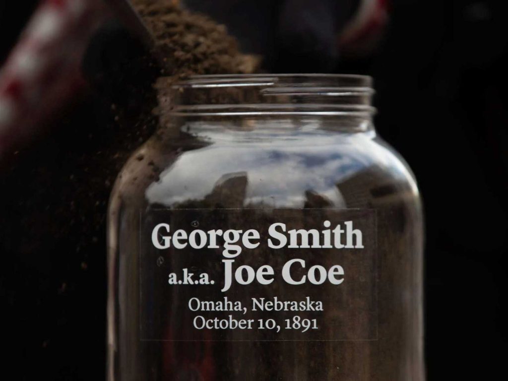
RACIST CRIME: 1891 George Smith Lynching | 1910 Jack Johnson Riot | 1917 Larkin McCloud Case | 1919 James Smith Death | 1919 Will Brown Lynching | 1969 Vivian Strong Killing | 1960s North Omaha Riots | Police Brutality | Mob Violence | Gentrification
MY ARTICLES ABOUT HISTORIC NEIGHBORHOODS IN NORTH OMAHA
National Register of Historic Places Historic Districts in North Omaha: 24th and Lake Historic District | Benson Downtown Historic District | Country Club Historic District | Dundee/Happy Hollow Historic District | Fairacres Historic District | Fort Omaha Historic District | Minne Lusa Historic District | Nicholas Street Historic District
Historic Neighborhoods in North Omaha: Bedford Place | Belvedere Point | Bemis Park | Benson | Briggs | Bungalow City | Carter Lake, Iowa | Central Park | Clifton Hill | Collier Place | Creighton University | Crown Point | DeBolt | Druid Hill | East Omaha | Fairfax | Florence | Florence Field | Fort Omaha | Fontenelle View | Gifford Park | Gold Coast (Cathedral) | High Point | Jefferson Square | Kellom Heights | Kountze Place | Lakewood Gardens | Little Russia | Long School | Malcolm X Memorial | Miller Park | Miller Park Duplex Historic District | Monmouth Park | Montclair | Near North Side | North Downtown Omaha | Omaha View | Orchard Hill | Plum Nelly | Prairie Park | Prettiest Mile in Omaha | Prospect Place | Raven Oaks | Redman | Saratoga | Sherman | Squatter’s Row | Sulphur Springs | Ponca Hills | Wakonda | Walnut Hill | Winspear Triangle | Wyman Heights
Lost Towns in North Omaha: Benson | Briggs | Cutler’s Park | DeBolt | East Omaha | Florence | Saratoga | Sulphur Springs | Winter Quarters
MY ARTICLES ABOUT BLACK HISTORY IN OMAHA
MAIN TOPICS: Black Heritage Sites | Black Churches | Black Hotels | Segregated Hospitals | Segregated Schools | Black Businesses | Black Politics | Black Newspapers | Black Firefighters | Black Policeman | Black Women | Black Legislators | Black Firsts | Social Clubs | Military Service Members | Sports
PIONEER BLACK OMAHA: Black People in Omaha Before 1850 | The First Black Neighborhood | Black Voting in Omaha Before 1870 | Racist Laws Before 1900 |
EVENTS: Stone Soul Picnic | Native Omahans Day | Congress of Black and White Americans | Harlem Renaissance in North Omaha
RELATED: Race and Racism | Civil Rights Movement | Police Brutality | Redlining
NEBRASKA BLACK HISTORY: Enslavement in Nebraska | Underground Railroad in Nebraska | Grand Island |
TIMELINES: Racism | Black Politics | Civil Rights | The Last 25 Years
RESOURCES: Book: #OmahaBlackHistory: African American People, Places and Events from the History of Omaha, Nebraska | Bibliography: Omaha Black History Bibliography | Video: “OmahaBlackHistory 1804 to 1930” | Podcast: “Celebrating Black History in Omaha”
MY ARTICLES ABOUT CIVIL RIGHTS IN OMAHA
General: History of Racism | Timeline of Racism
Events: Juneteenth | Malcolm X Day | Congress of White and Colored Americans | George Smith Lynching | Will Brown Lynching | North Omaha Riots | Vivian Strong Murder | Jack Johnson Riot | Omaha Bus Boycott (1952-1954)
Issues: African American Firsts in Omaha | Police Brutality | North Omaha African American Legislators | North Omaha Community Leaders | Segregated Schools | Segregated Hospitals | Segregated Hotels | Segregated Sports | Segregated Businesses | Segregated Churches | Redlining | African American Police | African American Firefighters | Lead Poisoning
People: Rev. Dr. John Albert Williams | Edwin Overall | Harrison J. Pinkett | Vic Walker | Joseph Carr | Rev. Russel Taylor | Dr. Craig Morris | Mildred Brown | Dr. John Singleton | Ernie Chambers | Malcolm X | Dr. Wesley Jones | S. E. Gilbert | Fred Conley |
Organizations: Omaha Colored Commercial Club | Omaha NAACP | Omaha Urban League | 4CL (Citizens Coordinating Committee for Civil Rights) | DePorres Club | Omaha Black Panthers | City Interracial Committee | Providence Hospital | American Legion | Elks Club | Prince Hall Masons | BANTU | Tomorrow’s World Club |
Related: Black History | African American Firsts | A Time for Burning | Omaha KKK | Committee of 5,000
Leave a Reply