There are a few neighborhoods north of Dodge Street and east of 72nd Street that are… different. Some were old towns, some were tiny hamlets and some were just kinda there. This is a history of the Sherman neighborhood at North 16th and Fort Streets.
For the sake of this article, I’m including the area north of Cornish Boulevard and from the cliffs behind Florence Boulevard east to Carter Lake and Abbott Drive as the Sherman neighborhood. Although people call this area “East Omaha” today, this article does not include the old town of East Omaha or Levi Carter Park.
Finally, I researched and wrote this as an homage to the neighborhood where my family lived for a short time in the 1980s. Hiding in the Garden Valley tornado shelter, riding the Sherman Community Center van to swim at the Adams Park Community Center, being told the “monkey man” story over and over, and many other parts of my Sherman neighborhood history hang in my imagination still today. Also, much love to the former members of Asbury.
Old Neighborhood History

People have occupied and lived in the area of the Sherman neighborhood for thousands of years. Long before today’s American Indian tribes and nations were in the region around Omaha, there were Woodland Natives who occupied the area for thousands of years.
As soon as the Nebraska Territory was opened for settlement in 1854 people flocked across the Missouri River from Iowa and started building houses, staking claims and starting towns. One of the early towns was called East Omaha, and it was located south of Eppley Airfield around Locust Street. This town was different from the Sherman neighborhood. Another early town was Sulphur Springs at Carter Lake Boulevard and Locust Street. North of all of that was the City of Florence. However, down around the Missouri River—which originally included the Carter Lake—was a no-man’s land. The area was out in the sticks and it flooded regularly but because of that, it was fertile river bottom land that was ideal for farming. Using horses, wagons and running small farm, some of the area filled with truck farms.
Early family farms in the area were owned by families named Nelson, Sesseman, O’Donnell, Hellman, Cook, Forbes and Hazard. The Creighton family invested in land in the area, too.
Another part of the area developed though. Starting in 1885, small houses popped up near North 16th Street and Fort Streets, and from this a neighborhood grew. Truck farms surrounded the entire area. The neighborhood was named for the main street leading to it, which was named for General William Tecumseh Sherman, and the neighborhood school was named for the Union Army Civil War hero, too. There was some activity in the area before the Sherman neighborhood grew up, including a resort at Florence Lake and several roadhouses along the county roads in the area. There were also vacation houses there and along the Nakoma Lake, including a neighborhood called Bungalow City located on the north shore where the big sign is for present-day Levi Carter Park.
The history of the Sherman neighborhood is one of changes, sometimes drastic and other times subtle. After a vacation trailer court opened on JJ Pershing Drive at Read Street in the 1920s, that area evolved into a permanent trailer court right after World War II. Other trailer courts took hold and by the 1950s there were five major areas for mobile homes in the Sherman neighborhood. Today they are disappearing too.
The small Bungalow City summer homes were moved to the Sherman neighborhood along Fort Street in the early 1900s and became permanent homes in that area by Levi Carter Park.

Early in the 20th century the City of Omaha opened the Municipal Beach on Carter Lake, drawing visitors from across Omaha into the neighborhood. In the 1930s the Works Progress Administration funded by the New Deal by FDR built a Civilian Conservation Corps (CCC) camp on Grand Avenue in Levi Carter Park. Florence Lake was permanently drained in the 1920s and a swill pond between Storz and Hartman by North 4th Avenue is all that’s left of it today. The truck farms that once filled the area are now almost all gone, replaced by manufacturing plants, shipping warehouses, and airport-related parking lots.
In 1927, the Lakewood Gardens subdivision immediately east of the Sherman neighborhood was platted and began selling. Advertised as mini-farms of one acre and less, lots and small homes were sold there for the next decade.
Despite current trends, the Sherman neighborhood has been painted with potential in the past. In the 1930s the community was included in a citywide tour led by business and civic leaders touting the city’s virtues to visitors. In the 1970s the neighborhood was promised upgrades by the City government. However, it has always fought blight and neglect, too.

The Garden Valley Trailer Court was opened for business in 1949. That year, a state-of-the-art laundry room was built and amenities were installed throughout the court. Located at 5702 North 16th Street, for more than a half century the court had more than 50 homes. The trailer court was never updated though, and the trailers slowed decayed and fell apart for the next 70 years. In 2021, the trailer court was entirely bulldozed and there is nothing remaining.
Weather has always afflicted the Sherman neighborhood in negative ways, especially heavy rainfall. Without a neighborhood-wide sewer system and lines for homes to connect to, and with an absence of storm drains throughout the neighborhood, flooding is a nearly constant crisis and has been for more than a century. Surrounding industrial development has benefited from the City’s installation of these routine elements, but not the people living in the neighborhood.

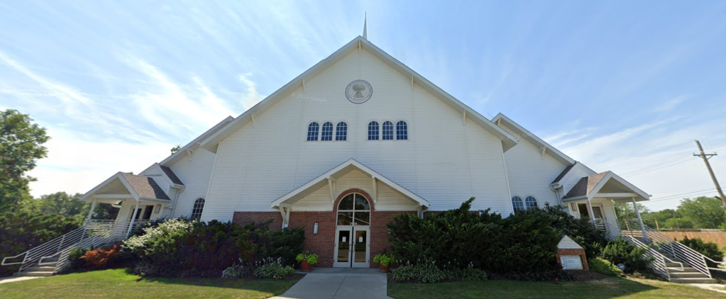
Historic churches located in the Sherman neighborhood were Asbury United Methodist Church, a small mission that was located near North 15th and Fort Streets, and the St. Therese of the Child Jesus Catholic Parish, formerly located at 1423 Ogden Avenue, as well as well as the newer Pentecostal Church Gateway of Heaven and Faith Baptist Church on North 15th Street. Asbury opened in the 1920s and closed in the 2010s. St. Therese of the Child was organized in 1918 and held its final mass in 2013. Faith Baptist is still open, and the Church of Jesus Christ Whole Truth is now in the former St. Therese church.
Houses

The housing stock in the Sherman neighborhood is largely historical, with many homes more than a century old. They are simple bungalows and “shotgun shacks” with little architectural significance. Some of the houses in the neighborhood were built after World War II to help cover Omaha’s housing shortage for veterans; others were built in the 1950s as new housing for residents from the former town of East Omaha obliterated by flooding that decade. They represent the working-class heritage of the neighborhood. Its the 100-year-old-plus houses that deserve recognition for their value to the people who live there though, as they are the oldest reminders of this area’s rural-type roots.
Some of the historic homes in the neighborhood that are more than 110 years old include…
- 4525 North 16th Street, built in 1910
- 4711 North 16th Street, built in 1915
- 5103 North 16th Street, built in 1905
- 5311 North 16th Street, built in 1915
- 5417 North 16th Street, built in 1897
- 5522 North 16th Street, built in 1909
- 5622 North 16th Street, built in 1912
- 5702 North 16th Street, built in 1914
- 1510 Ellison Avenue, built in 1912
- 4515 N 18 Street, built in 1915
- 1319 Ames Avenue, built in 1900
- 1414 Ames Avenue, built in 1905
In addition to lacking many of the basic elements provided to almost every other house in Omaha, including sewers, streetlights and sidewalks, many of the Sherman neighborhood’s historic homes are included in the Omaha Superfund area and have been afflicted by lead poisoning for decades. While remediation happened in some of the neighborhood, there are houses that didn’t benefit from new soil or home improvement programs for low-income people. They are still valuable, but need the appropriate attention that the City of Omaha has neglected to provide.
Transportation

Transportation has always affected the Sherman neighborhood a lot. Originally the Sherman neighborhood had just a few dirt roads through the area, along with an old wide north-south dirt highway for wagons.
From the 1890s through 1955, there was a streetcar that traveled to North 16th and Ames Avenue to shuttle residents to jobs in and near downtown Omaha. Railroads jutted through the area, with the Union Pacific, Illinois Central, and the Omaha Road all occupying Sherman neighborhood at some point. As early as 1981, the City of Omaha planned to dissect the area with the Storz Parkway, which was intended to link up with Abbott Drive to create a smooth highway through the area to access the airport. Major roads into Sherman today are North 16th Street, Storz, Pershing Drive and Abbott Drive. Locust Street and Carter Boulevard aka Horseshoe Bend also give access, along with the Carter Lake Drive. The Union Pacific Railroad still owns an abandoned right-of-way from Carter Lake to Read Street.
There were historically two important intersections in the Sherman neighborhood, including North 16th and Ames Avenue and North 16th and Carter Boulevard/Grand Avenue. North 16th and Fort was important from the 1880s through the 1950s, when Fort Street connected up the hill from North 24th to North 20th Street.
The intersection at North 16th and Grande Avenue might have been the most important in the neighborhood, and the busiest too. This area was originally an 1870s sub-development called North Omaha, and the newspaper referred to the area that way into the 1950s. That corner once had a drug store, grocery stores, two bars and the longstanding Nite Hawkes Cafe (see below). There were several grocery stores at the intersection over the years, including M. Franklin’s Naborhood Store in the 1920s and J. Bernstein’s store there in the 1930s and 1940s. MUD ran an ice station at the intersection for a few decades too. There they sold massive blocks of ice for use in home freezers before electric cooling happened. There was a building on the corner for the “North Omaha Improvement Association,” which was originally an advocacy group trying to get the City to invest more money into the area.

There is nothing of note left at North 16th and Ames Avenue today. The southwest corner is a dump, and the southeast corner has some kind of non-public charity there. However, at the turn of the 20th century there was an ice cream and confectionery store there for more than a decade. Starting in 1890, there were several drug stores at this corner, including the Saratoga Drug Store. Starting in 1921, there was a gas station at this intersection, and across from that there was a two-story grocery store.
Two of Omaha’s historic boulevards are located in the Sherman neighborhood. The Carter Boulevard runs from Florence Boulevard down Horseshoe Hill to the Carter Lake Drive. The Cornish Boulevard runs from North 16th to the Carter Lake Drive. Both were built in the first decade of the 20th century to move visitors to Levi Carter Park quickly. However, neither boulevard is treated like the rest of the city’s boulevards: They don’t have sidewalks, curbs or many streetlights. There is no sewer or gutters. Instead, they both add to the rural feeling of the Sherman neighborhood and ultimately detract instead of add to the place.
In the 1910s there was a plan to take the City’s new, illustrious River Drive from Bellevue through the Sherman neighborhood north to Dodge Park. The drive was never made.
Today, there are still gravel roads in the Sherman neighborhood. It is routinely neglected and denied by the City of Omaha for street maintenance and cleanup, and there are no signs of that improving.
Sherman School

There had been a one-room schoolhouse located near North 16th and Fort Street for decades. After the City of Omaha annexed the Sherman neighborhood into the City in 1887, the Omaha school board voted to replace the original one-room schoolhouse with a larger building in 1891. There was also another school near North 9th Street East and Fort Street, and eventually one near North 20th and Read Streets. Eventually all of these buildings were merged into Sherman School, along with the population of the old Pershing School in the old town of East Omaha. The new building was finished in 1892, and was a two-room schoolhouse. Sherman School has been at North 14th and Ellison since. The school boomed in population for a few years, and annexes were quickly added. For many decades it was difficult to get Sherman’s students to start the school year on time since many were involved with family farms and would be tending gardens and harvesting into early October.
In 1948, the Beechwood School building was moved here to accommodate students from there when their school district was absorbed by Omaha Public Schools. The Beechwood area was north of Sherman near Read Street and JJ Pershing Drive, and the school had existed since the 1890s before it was closed.
After serving kindergarten through eighth grade its entire existence, in 1976 junior high students started getting bused to McMillan. Later, the building split its elementary population with Miller Park Elementary, and today Sherman School has pre-K through fifth grade students. Its address is 5614 North 14th Street.
From the 1930s through the 1950s, part of Sherman school was used as a community center that hosted summertime and holiday programs for children and youth in the area. There were day camps, athletic activities and more throughout the decades before the Sherman Community Center was built. In 1976 residents of the Sherman neighborhood asked the City of Omaha for almost $900,000 to build a community center. The City denied their request and designed a building for half that cost, and opened it soon after. It continues today at 5701 North 16th Street.
Businesses

Some of the first businesses in the modern-day Sherman neighborhood were roadhouses located along county roads, which were dusty old wagon roads that jotted through the area. Those roadhouses were essentially bar and grills, some with hotel rooms available for rent. The old Florence Lake near North 9th Street and Storz Expressway had a hotel and restaurant for several years until the City of Omaha demolished the lake around 1920.
From 1891 to 1905, the corner of North 13th and Ames Avenue was home to the Hotel Boulevard. This hotel was for visitors to Cut-Off Lake, which was later renamed Carter Lake.

Albert’s Fine Foods had a factory at 5222 North 16th Street, also referred to as 1604 Fort Street, for decades. Russian immigrant Louis Albert (1897-1991) started the business in 1949 with his son Larry, selling salad dressings to Mr. C’s and other restaurants. Closing the North 16th plant in 2002, the brand was regarded as a household name across the Midwest. The plant might still be making the brand today though—I can’t tell. Share what you know in the comments? The business was co-located with Sortino’s Fruit Company, which sold fresh fruits and vegetables to local restaurants. Today, Water Link, Inc. operates in the former Albert’s Fine Foods building on the southwest corner of North 16th and Fort. Across the street from that is a gas station. That location has had a gas station there since the 1920s.
For years, the most visible business in the Sherman neighborhood was Bob’s Market on the northeast corner of North 16th and Fort Streets at 5301 North 16th Street. Albert Wohlner opened the store originally in 1918, and sold it to Harold Kooperman in the 1920s. Bob Weary bought it during the Great Depression and renamed it for himself. Ed Olsen, aka Pops, bought it in 1947. Pops kept it through 2000. It was later sold to new owners who kept the business name. The store was destroyed by arsonists in 2007, who attacked the store owner and burned down the building.
After World War II, the Broken Rail Bar was opened at 4910 North 16th Street by Ray R. O’Donnell (1896-1966). For the next 60-plus years, the bar was a important place for people who lived in the Sherman neighborhood and beyond. Located on the edge of Omaha, the bar was a rough-and-tumble water hole that attracted workers, bikers and kids who went in the back door to get “the coldest pop in Omaha.” The cigarette vending machine in the front was popular in the area, and the bar had more stories than it could tell. The located of many robberies and break-ins, there were countless fights and even a few deaths at the bar. Donald (Tim) Sweeney (1943-2003) was one of the last owners of the Broken Rail. That bar closed around 2010. The bar sat catty corner to Nite Hawkes Cafe.
Opened in 1942 in a two-story building at 4825 North 16th Street on the corner of North 16th and Grand Avenue, the Nite Hawkes Cafe was started in a two-story building by Dan and Alice Hawkes. The iconic neighborhood institution is still open today, and is the longest-running restaurant in Omaha.
A longtime fixture in the Sherman neighborhood was the Waggin’ Tongue bar at 6508 North 16th Street. From around 1965 through 2004, the bar was a gathering spot for locals, bikers, workers and others in the area.
The Sherman neighborhood was once next to several large ice houses located on Carter Lake. Men from the neighborhood would work at these businesses in the wintertime, cutting ice and loading it onto railroad cars for shipment around Omaha and across Nebraska. These businesses ran from the 1890s through the 1940s.
In 1967, the Lozier Corporation built a large factory on J.J. Pershing Drive north of the Sherman neighborhood, expanding on their operations based in the Saratoga neighborhood. In 1989, the company moved to a new headquarters in the Pershing Drive facility, and opened a large warehouse there. Today, the area north of the Sherman neighborhood continues as home to Lozier’s major operations.
Further east of North 16th there were other businesses. Located at North 8th and Fort Street, Jen’s Grocery was a “five and dime” and grocery store with a variety of goods at that location through the 1960s. It might have been there for 20-30 years before that.
Other businesses in the Sherman neighborhood through the years included the Kiddieland and Pleasure Pier amusement park in the 1950s. Leave other notable businesses in the comments section.
Racism

The Sherman neighborhood has a long history associated with racism and white supremacy. Dozens of unreported incidents and several highly visible events mark the neighborhood, and many people believe living there is off-limits to African Americans. Following are some examples.
In 1981, an African American family signed a lease for a duplex rented by HUD located in the Sherman neighborhood. However, within a week the home was burnt down and the case went unsolved. In 1995, arsonists tipped over, burned and destroyed an African-American woman’s car at the same location as the 1981 arson. The case is unsolved.
In one of the most explicit examples of racism in the Sherman neighborhood, arsonists destroyed a longtime business and almost killed its owner. Bob’s Grocery, which was located at North 16th and Fort for almost a century, was bought by an Ethiopian businessman named Kassahun Goshime in 2007. Within a few months of opening he was being constantly targeted for crime, including racist graffiti and vandalism. In February, he was bound and gagged and locked in the basement when two men raided his store. They shouted racial epithets at him and ransacked the building, then burned it to the ground. Goshime escaped before he was killed, and eventually moved away from Omaha for fear of his life. Nobody was ever arrested for the crime.
In 2007, the federal government made a series recommendations because of “resident’s concerns about the racial climate in the area.” After investigating the arson as a racially-motivated hate crime, neither the Omaha Police Department or the FBI charged anyone with a crime. The FBI did recommend the City of Omaha do a better job of keeping up on “low level crime” in the neighborhood such as vandalism and graffiti.
However, there have been few sustained efforts to fight the white supremacy culture in this neighborhood.
Current Times
The Sherman neighborhood has been struggling for decades. Wholly neglected by the City of Omaha, it has been the target of government schemes to build toxic waste incinerators, high speed expressways, and industrial wastelands throughout the neighborhood. Many of these schemes have worked.
There are still several homes in the neighborhood on septic systems, more than a century after the neighborhood was founded. Sidewalks and streets are crumbling, and the City of Omaha appears to not care at all, and has routinely designated the neighborhood as “blighted” and many of the homes as being in “poor” condition.
For the last 25 years, suspicious fires have marked the Sherman neighborhood. In addition to the racist attacks in 1981, 1997 and 2007, there have been other fires happening under mysterious circumstances. In 2015, the International Paper Company at 1111 Fort Street had a large fire that covered the neighborhood in smoke.
The City has promised the Sherman neighborhood many developments, including the development of a business park, improved streets, fostering reuse of existing buildings, preserving the houses in the neighborhood, and beautifying Abbott Drive. However, little of that has come to fruition. The City’s benign neglect and determined denial of residents’ rights is surely a way of pushing people out of the neighborhood, much the same as they did to the nearby town of East Omaha in the 1950s.
Today, the historical assets of the Sherman neighborhood are being plowed over constantly, built on, forgotten or neglected. There are no buildings or houses listed on the National Register of Historic Places from the neighborhood, and there is no attempt to recognize the historic nature of the community.
Maybe someday that will change.
Historic Places in the Sherman Neighborhood
- Sherman Elementary School, built in 1923
- St. Therese of the Child Jesus Catholic Parish located at 1503 Ogden Avenue, built in 1921
You Might Like…
MY ARTICLES ABOUT THE HISTORY OF EAST OMAHA
SEE ALSO: East Omaha History Tour
AREAS: Town of East Omaha | Carter Lake | Winspear Triangle | North Omaha Bottoms | Sherman | Sulphur Springs | Edgewood Park | Bungalow City | Squatter’s Row | Lakewood Gardens | East Omaha Factory District
BUSINESSES: East Omaha Truck Farms | Carter White Lead Company | Nite Hawkes Cafe | Railroads
CARTER LAKE, IOWA: Courtland Beach | Omaha Rod and Gun Club | Carter Lake Club | Sand Point Beach and Lakeview Amusement Park | Omaha Auto Speedway
CARTER LAKE PARK: Municipal Beach | Bungalow City | Pleasure Pier and Kiddieland
PEOPLE: Selina Carter Cornish | Levi Carter | Granny Weatherford
TRANSPORTATION: Ames Avenue Bridge | Eppley Airfield | 16th and Locust Streets | JJ Pershing Drive | North 16th Street | Pulitzer Airfield | Locust Street Viaduct
SCHOOLS: Beechwood School | Pershing School | Sherman School | St. Therese Catholic School
OTHER: The Burning Lady | CCC Camp | St. Therese Catholic Church | 1898 Trans-Mississippi Exposition
Listen to our podcast “A History of East Omaha” online now!
MY ARTICLES ABOUT THE HISTORY OF NORTH 16TH STREET
Places: 16th and Locust Historic District | Charles Street Bicycle Park | State Bar and McKenna Hall | Storz Brewery | Warden Hotel | Grand Theater | Nite Hawkes Cafe | Tidy House Products Company | 2621 N. 16th St. | New Market | 3702 N. 16th St. | Sebastopol Amphitheater
Historic Homes: J.J. Brown Mansion | Poppleton Mansion | Governor Alvin Saunders Estate | Ernie Chambers Court aka Strehlow Terrace | The Sherman Apartments | The Climmie Apartments
Neighborhoods: Near North Side | Lake Street | Kountze Place | Saratoga | Sulphur Springs | Sherman
Events: 1898 Trans-Mississippi and International Exposition | 1899 Greater America Exposition | 1960s North Omaha Riots | “Siege of Sebastopol”
MY ARTICLES ABOUT HISTORIC NEIGHBORHOODS IN NORTH OMAHA
National Register of Historic Places Historic Districts in North Omaha: 24th and Lake Historic District | Benson Downtown Historic District | Country Club Historic District | Dundee/Happy Hollow Historic District | Fairacres Historic District | Fort Omaha Historic District | Minne Lusa Historic District | Nicholas Street Historic District
Historic Neighborhoods in North Omaha: Bedford Place | Belvedere Point | Bemis Park | Benson | Briggs | Bungalow City | Carter Lake, Iowa | Central Park | Clifton Hill | Collier Place | Creighton University | Crown Point | DeBolt | Druid Hill | East Omaha | Fairfax | Florence | Florence Field | Fort Omaha | Fontenelle View | Gifford Park | Gold Coast (Cathedral) | High Point | Jefferson Square | Kellom Heights | Kountze Place | Lakewood Gardens | Little Russia | Long School | Malcolm X Memorial | Miller Park | Miller Park Duplex Historic District | Monmouth Park | Montclair | Near North Side | North Downtown Omaha | Omaha View | Orchard Hill | Plum Nelly | Prettiest Mile in Omaha | Prospect Place | Raven Oaks | Redman | Saratoga | Sherman | Squatter’s Row | Sulphur Springs | Ponca Hills | Wakonda | Walnut Hill | Winspear Triangle | Wyman Heights
Lost Towns in North Omaha: Benson | Briggs | Cutler’s Park | DeBolt | East Omaha | Florence | Saratoga | Sulphur Springs | Winter Quarters
Elsewhere Online
- “History” Sherman Elementary official website
- Levi Carter Sherman Neighborhood Association facebook page

Leave a comment