This is a history of the Ames Avenue Bridge, which stood between the City of Omaha, Nebraska, and the City of Carter Lake, Iowa from circa 1890 to 1913.
As late at 1950, Ames Avenue continued due east from the Saratoga neighborhood straight down the hill to connect directly to Ames Avenue past North 16th Street instead of ending at Commercial Avenue. It stayed connected as it went east toward Carter Lake.

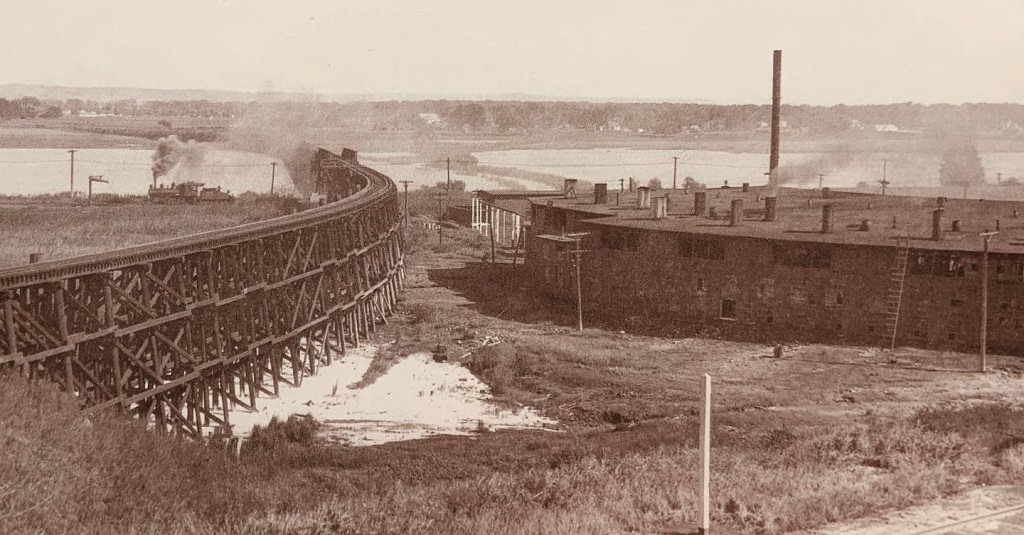
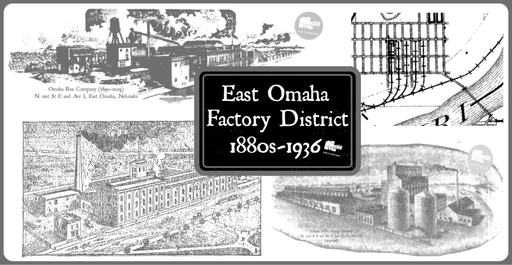
Once upon a time there was a bridge between Ames Avenue in North Omaha and Ave R in Carter Lake, which was originally called Ames Avenue too. Built circa 1890 by the Illinois Central Railroad, it was a railroad bridge that carried cargo from points west across the lake and towards the East Omaha Factory District, and in the other direction, from the east to Saratoga, Florence, and all points north.

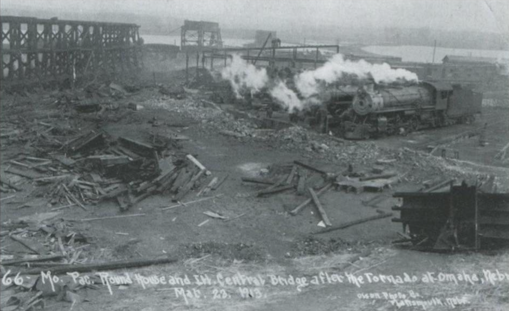
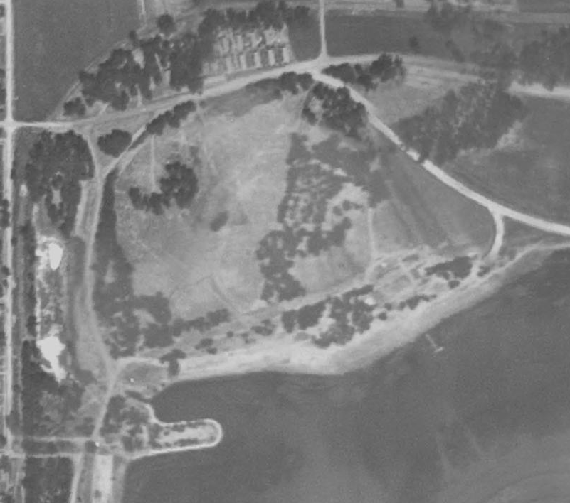
After it was destroyed by the 1913 Easter Sunday tornado, the bridge was never rebuilt. In the mid-1930s, federal workers from the Carter Lake Civilian Conservation Corps (CCC) Camp demolished the rest of the bridge, which had been rotting in place for more than 20 years. They refurbished the western approach to the bridge as an earthen fishing pier and boat landing by adding cement block walls and planting a tree.

In the 1950s, the pier was refurbished again by a private investor to become the Carter Lake Pleasure Pier. There was a concession booth and dance floor built there, and with ample parking and the Carter Lake Kiddieland nearby it was a popular attraction for almost a decade.

Today, the original western approach to the Illinois Central Bridge across Carter Lake is still intact, and sometimes used for fishing. In Omaha, go to Ames Avenue and Carter Lake Shore Drive West, and then walk to the end of the pier. In Carter Lake, go to Wavecrest Park near Shoreline Drive, where there are no remnants. Neither side has a historic marker acknowledging the site.
Special thanks to Ryan Roenfeld for his contributions to this article.
You Might Like…
MY ARTICLES ABOUT THE HISTORY OF EAST OMAHA
SEE ALSO: East Omaha History Tour
AREAS: Town of East Omaha | Carter Lake | Winspear Triangle | North Omaha Bottoms | Sherman | Sulphur Springs | Edgewood Park | Bungalow City | Squatter’s Row | Lakewood Gardens | East Omaha Factory District
BUSINESSES: East Omaha Truck Farms | Carter White Lead Company | Nite Hawkes Cafe | Railroads
CARTER LAKE, IOWA: Courtland Beach | Omaha Rod and Gun Club | Carter Lake Club | Sand Point Beach and Lakeview Amusement Park | Omaha Auto Speedway
CARTER LAKE PARK: Municipal Beach | Bungalow City | Pleasure Pier and Kiddieland
PEOPLE: Selina Carter Cornish | Levi Carter | Granny Weatherford
TRANSPORTATION: Ames Avenue Bridge | Eppley Airfield | 16th and Locust Streets | JJ Pershing Drive | North 16th Street | Pulitzer Airfield | Locust Street Viaduct
SCHOOLS: Beechwood School | Pershing School | Sherman School | St. Therese Catholic School
OTHER: The Burning Lady | CCC Camp | St. Therese Catholic Church | 1898 Trans-Mississippi Exposition
Listen to our podcast “A History of East Omaha” online now!
MY ARTICLES RELATED TO THE HISTORY OF AMES AVENUE
NEIGHBORHOODS: Saratoga | Collier Place | Monmouth Park
INTERSECTIONS: 30th and Ames | 40th and Ames | 24th Street | North Freeway | Fontenelle Boulevard
BUSINESSES: LaRue’s | Max I. Walker | North Star Theater aka Ames Theater | King Solomon’s Mines aka Shaver’s | Beacon Theater | Parkside Cafe | Ames Plaza | Battiato’s Super Market | Mergen House
PUBLIC PLACES: Ames Avenue Bridge | Saratoga School | Charles Washington Branch Library | Monmouth Park School | North High School | Fontenelle Park
OTHER: Druid Hall | St. Vincent’s Retirement Home | Ames Avenue United Methodist Church | Mergen House
MY ARTICLES ABOUT THE HISTORY OF PARKS IN NORTH OMAHA
PARKS: Adams Park | Miller Park | Fontenelle Park | Kountze Park aka Malcolm X Park | Hummel Park | Levi Carter Park | Jefferson Square Park
PRIVATE PARKS: Danish Vennelyst Park | Omaha Driving Park | Charles Street Bicycle Park | Omaha Rod and Gun Club | Carter Lake Club
AMUSEMENT PARKS: Kiddieland and the Pleasure Pier | Lakeview Amusement Park | Cortland Beach | Trans-Mississippi and International Exposition
RELATED: Kellom Pool | Omaha Municipal Beach | CCC Camp | Ames Avenue Bridge
BONUS


Leave a comment