The Church of Latter Day Saints escaped across the Missouri River to Indian Country in 1846. Their short-lived first settlement became this region’s first town, eight years before the 1854 Kansas-Nebraska Act created Nebraska Territory. This is a history of Cutler’s Park.
A Brief History

In early August 1846, the leaders of the Mormons secured permission from a U.S. Indian agent to temporarily stay on the western side of the Missouri River across from Kanesville in the then-new state of Iowa. This agent was responsible for several western Iowa American Indian nations, as well as tribes west of the river. After supposedly consulting with tribal leaders in modern-day Nebraska, he gave the Mormons permission to stay in the Indian Territory on the land just across the river from Iowa, in a specifically designated location.
Crossing at Rock Bottom, a stone-lined place near bluffs along the river, the leaders of the group weren’t happy with the land they received permission to stay on. It was a wide-open tableland, flat with few trees but lined to the west and north with forests across hillsides. The leaders thought this land was too exposed to the winds of the Missouri River Valley and took it upon themselves to seek a better area to set up the travelers. Heading a mile west over the hills, the 2,500 travelers came to the valley where the present-day Mormon Bridge Road runs. Heading south, they quickly erected a small town at the present-day intersection of Mormon Bridge Road and Young Street.
Named Cutler’s Park for a leader of the traveling party, the town was laid out on a grid pattern with straight streets and 90′ intersections, with a town square and businesses in the middle. There were tents, wagons and a few cabins for the 2,500 residents. Some of the other features of Cutler’s Park included…
- A mayor and town council, town ordinances, and administrative committees for the town.
- 24 official policemen and firefighters
- Private schools for general education and the Arts
- An anti-pollution and fire ordnance, which was a regulation banning open burning, the first in Nebraska
Cutler’s Park was the first European American town in Nebraska, and for two months it served as the headquarters of The Church of Jesus Christ of Latter-day Saints. Before Cutler’s Park there were dozens of Mormon camps on the eastern side of the Missouri River. Cutler’s Park was preceded by a small camp to the south. Calling all of the travelers in the Iowa camp to come together with the first Nebraska camp is what swelled the size of the new town to be so big.
As quickly as the town was laid out and occupied though, it was soon abandoned. Six weeks after getting their establishment set up and churning, the site was visited by a group of American Indian leaders, then recognized as the owners of the land. Upset because the town was located in prime hunting territory, they insisted the Mormons move their town back to the designated location. According to one account (whose verity is unproven),
“Late in August, almost [ninety] Omaha and nearly that many Oto Indians walked unexpectedly into Cutler’s Park, asking rent for use of the Cutler’s Park land.” “Brigham Young, the leader of the Mormons (although not President of the Mormon Church at the time) met with the Indians. A war nearly broke out when the Omaha/ Ottawa/ Chippewa natives were offered the same rent as the Oto/ Missouri natives. The Omaha/ Ottawa/ Chippewa natives had only been in the area since 1843 (three years earlier) but the Oto had been in the are since the 1700s. At that point, the Church leaders made an agreement with Big Elk, chief of the Omaha nation, to live on land closer to the Missouri River. Immediately, camp was moved…by September 11th, 1846 Cutler’s Park had been completely vacated…” — Source
On August 27, 1846, meetings were held in a large tent in town. First meeting with the Omaha Nation, Brigham Young met Logan Fontenelle, the noted interpreter and leader among the Omaha. Young apparently offered the Native Americans for the Mormons to fix their guns, make a farm for the tribe, and “hire some of their young men to look after” the Mormons’ cows.
By the end of September 1846, all of the travelers had moved to Winter Quarters, as their new town was called. On the site of Cutler’s Park, the travelers left behind fenced areas and their streets and an improved spring for the area. Apparently, they grew about 800 tons of hay in that valley that helped supply the next group of Mormon travelers on their journey west the next year.
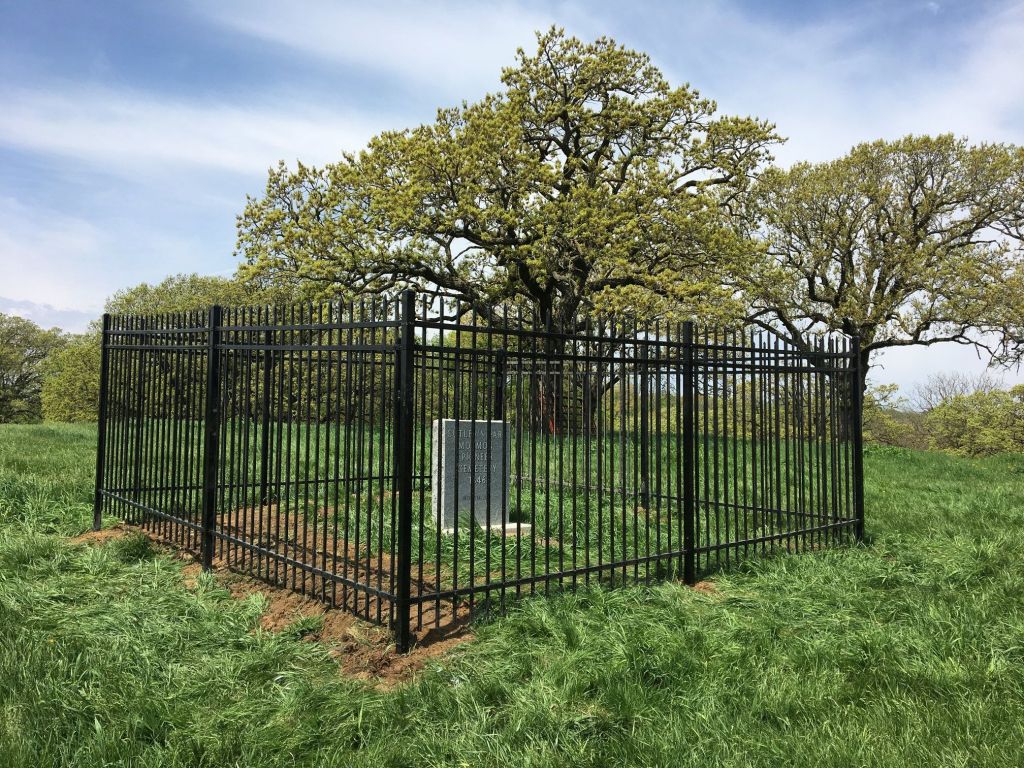
Laid out with the same diligence and determination as Cutler’s Park, Winter Quarters stayed intact through 1848. That year, the church began a mass migration to its new headquarters in Utah. With them went the memories of Cutler’s Park, the early town that turned out to be a mistake, and the cemetery that was re-identified only recently because of determined history researchers and advocates. They found 50 graves and identified the names, birthdates and death dates of each one. All of the interments happened between late August and early November 1846, with burials after that date happening at the Winter Quarters cemetery modern-day Florence.
Remembering Cutler’s Park
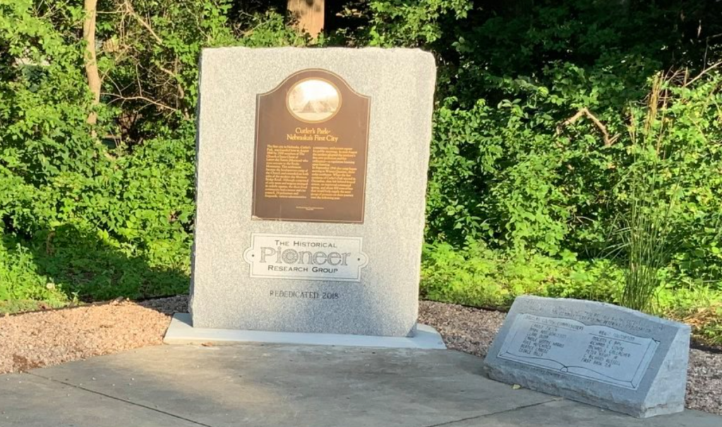
In 1986 a historical plaque was installed on the northeast corner of Mormon Bridge Road and Young Street. A park with flowers and more was laid out there in 1997. However, this site disintegrated.
In the 2010s, the Historical Pioneer Research Group took it upon themselves to commemorate the establishment of Cutler’s Park again. Centering their work at the Cooper’s Farm on the northwest corner of Mormon Bridge Road and Young Street, they had an engineering firm use technological equipment to confirm the burial locations of about 50 travelers at Cutler’s Park. After negotiating with the owners of the farm, the Omaha Home for Boys, the group established a Mormon Pioneer Cemetery monument on Cooper Farm. There is a marker on the site of the cemeter today, along with a fence around it. Today, there is a display panel on the northeast corner of the nearby intersection with the names of everyone buried in the Cutler’s Park cemetery.
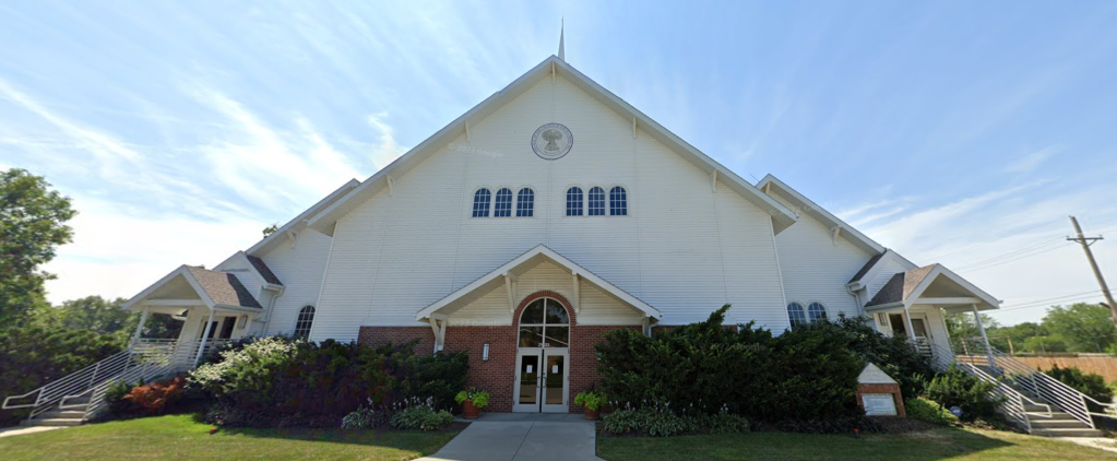
The Latter Day Saints built a major interpretive center at Winter Quarters Historical Site in 1997, and that is the best source of additional information on Cutler’s Park today.
Thanks to Linda Meigs for her edits on this article!
You Might Like…
MY ARTICLES ABOUT THE HISTORY OF FLORENCE
Public Places: Florence Main Street | Florence Ferry | Florence High School | The Mormon Tree | Florence Water Works | Mormon Bridge | Florence Boulevard | River Drive | J.J. Pershing Drive and Monument | Potter’s Field
Businesses: Bank of Florence | Florence Mill | Zesto
Houses: Parker Mansion | Brandeis Country Home | Lantry-Thompson Mansion | Mitchell House | Hunt Mansion
Other Historic Places: Cutler’s Park | Winter Quarters | Vennelyst Park | Florence Depot | Florence Home | Florence Building
People: James M. Parker | James Comey Mitchell | Florence Kilborn | Jacob Weber Sr.
Neighborhoods: Winter Quarters | Florence Field | Wyman Heights | High Point
Other: Directory of Florence Historic Places
Elsewhere Online
- “Cutler’s Park” from the Florence Historical Foundation
- “Winter Quarters Project” of Brigham Young University
- “Roadside park opened at site of Nebraska’s first city” by Dell Van Orden on April 26, 1997.
- Mormons at the Missouri, Winter Quarters, 1846-1852 by Richard E. Bennett in 2004.
Leave a comment