
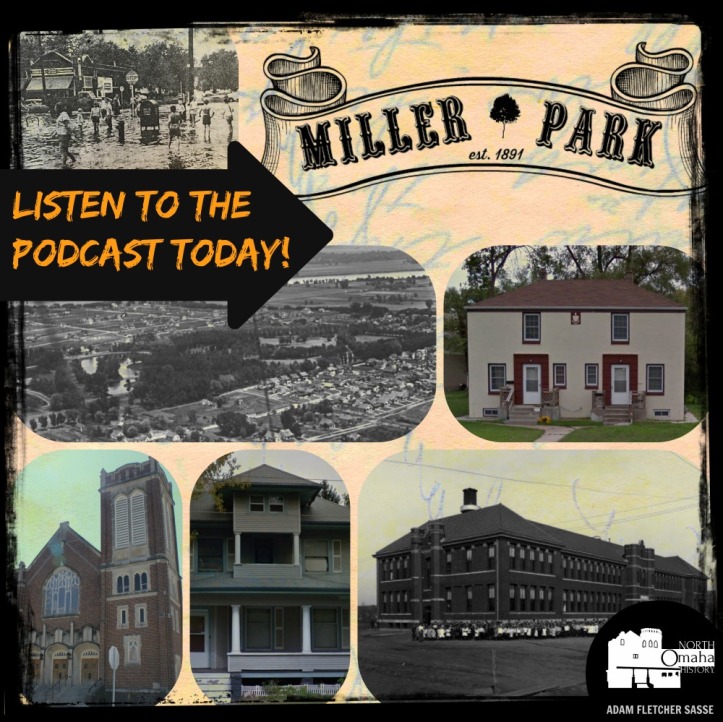
The place where I grew up, Omaha’s Miller Park neighborhood, rushes through my imagination a lot. I want to see it acknowledged, appreciated and accentuated every day. This article is my acknowledgment of the past and contribution to the future. Starting in the 1870s, the neighborhood was slow to in-fill, and didn’t finish until after World War II. By then, there were streetcars, stores, churches, a school, a park, paved streets, street lamps, curbs and sidewalks throughout the entire area. White flight struck the neighborhood hard starting in the 1970s, and by the 1990s it was predominantly African American. This is a history of the Miller Park neighborhood.
Coming From Where I’m From
The Miller Park neighborhood was the place where I learned to race dirt bikes, built forts, caught crawdads and threw newspapers. It was also were I got jumped more than a dozen times, watched gang bangers flood into and decimate the blocks, and heard drive-bys and other gun shots rattle all through my youth. Mamasan and Papasan, Mrs. Abernathy, Cal’s mom and Betty were all guardians who watched over me, while my spiritual teachers, Steve and Jamie and especially Helen taught me there. My brother and I got in fights while my sisters herded in wild cats and guinea pigs in the backyard, all in the Miller Park neighborhood.

I got my first job throwing newspapers for the Omaha World-Herald in the Miller Park neighborhood, and later Idu Maduli introduced me to my life’s calling. My dad’s awesome night hikes started in this neighborhood, and my love of the outdoors was impressed on me here through the Cub Scout den my mom led and the the Boy Scout troop my dad started where my friends and I earned our Eagle Scout awards. I love the Miller Park neighborhood dearly to this day, more than 20 years after I left.
In my teens I found a love for the mystery of the neighborhood’s history. The stories from old timers felt like they clashed with the realities I lived and my friends went through. Good ol’ days seemed to clash with real nows, juxtaposing soft suburban fantasies against the gritty depression of poverty that felt like it surrounded me.

This dichotomy is what tripped my trigger about North Omaha history, and its why I research and write this blog today. I’ve learned that my neighborhood is filled with gems in the forms of substantive historic homes, churches, a beautiful school and its once glorious namesake park. Here is what I’ve learned.
The Original Vision for Miller Park
Among many neighborhoods in North Omaha deserving historic status but missing it is my old neighborhood, Miller Park. Built as a distinct middle class enclave starting in the 1890s, the neighborhood grew between the south side of Miller Park and the old town of Saratoga steadily for 50 years. North 30th Street was originally connected from the Florence Main Street past Fort Omaha on purpose; the neighborhood was laid out along that line on purpose. It was originally bound by the Belt Line Rail Road on the south; Kansas Avenue and Miller Park on the north; Florence Boulevard on the east; and North 30th Street on the west.
The Miller Park neighborhood was anchored by churches, a military fort, and the park. Along almost its entire western edge is Fort Omaha, build in the 1870s to supply western US Army forts. On its northwest corner is the Episcopal Church of the Resurrection, located kitty corner from the neighborhood. Flanking the east side is Florence Boulevard, which while consisting of merely two lanes heading north and south, feels separate and distinct from the rest of the community.

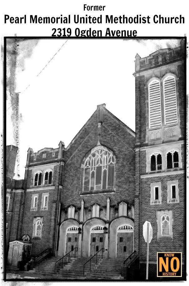
On its southeast corner is the old Pearl Memorial United Methodist Church, and on the northwest corner of the park is the old Miller Park Presbyterian Church. On the north is the park, and on the south was the Belt Line Rail Road. More on that follows.
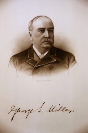
The main feature of the Miller Park neighborhood was what drew people to build there and keeps people satisfied: Miller Park. Built in 1891, Dr. George L. Miller sold the land to the City of Omaha cheaply after he failed to land the Trans-Mississippi Exposition on the site.
Dr. Miller envisioned the Miller Park neighborhood as a blissful suburban neighborhood covered with gorgeous trees, affordable homes, good transportation and all the amenities to serve residents.
The Belle Isle Addition

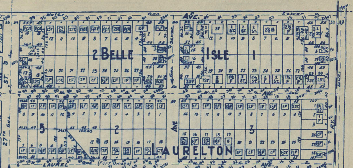
In 1914, developer Charles Martin launched his first well-known addition in the neighborhood. Known as Belle Isle, it lies on the northeast corner of the Miller Park neighborhood, extending from Crown Point Ave to Kansas Ave and North 24th Street to North 27th Street. The 60 lots within this plat are generally 44’x136’. His next project, which was much more substantive, was the Minne Lusa neighborhood north of the park.
Development in the Miller Park Neighborhood
The Miller Park neighborhood developed in fits and starts. The other subdivisions in the neighborhood were piecemeal and none of them compared to Belle Isle. They also didn’t compare to Martin’s later development. However, they built the neighborhood and still stand today.

As the 1890 map above shows, the Miller Park neighborhood was largely empty of development at that point. You can see the Rockford block and Seymore’s Addition, which were both north and east of present-day North 27th and Fort Streets. Two popular dirt roads traveled north and south through the neighborhood then, with one being Florence Avenue and the other, Butler Street. There were other smaller roads heading north, including Saunders Street, Beacon Street, Taylor Street and College Street. Don’t recognize those names? Today, Florence Avenue is Florence Boulevard; Butler Street is North 30th; Saunders Street/College Street is now called North 24th. Taylor Street is now North 27th, and Beacon Street became North 29th. Two east-west roads in the area had names: Browne Avenue stayed the same, and Park Street became Saratoga Avenue.Within a decade though, the neighborhood was really taking off. By 1900, there were several businesses clustered at North 30th and Fort for the soldiers and early airmen serving there. These included drug stores, restaurants, laundries, and similar businesses.
Writing about the 1890s, a 1935 history of Omaha reported that Dr. Miller and W. R. Adams developed the neighborhood “from a cornfield”. Throughout the neighborhood they planted 16,000 trees they’d bought from former Nebraska Governor Furnas.
One of the earliest developments in the neighborhood was called Firestone Boulevard, which is present-day North 28th Street.
Other Parts of the Neighborhood

Scattered throughout this neighborhood are several examples of its substantial architectural and cultural history that made Omaha a meaningful home for so many people. Different from its Minne Lusa neighbors, the Miller Park neighborhood filled in on its own volition without a development company or comprehensive plan. This led to several styles mixing throughout the neighborhood, from a pioneer brick house built in a vernacular style at 5415 North 24th Street to the squatty and intricate apartment building up the street at 5711th North 24 Street.
In the early 20th century, Hess and Swoboda Florists kept greenhouses in the Miller Park neighborhood. They were located along North 24th Street, from Himebaugh to Laurel, which was then called Fort Omaha Avenue and covered half a block.
The homes in the south and southwest corners of the Miller Park neighborhood are the oldest, while the ones in the Bell Isle subdivision were higher end than most of the area.
The Miller Park

“Miller Park is the Pride of North Omaha.”
–Omaha World-Herald, 1893
George Miller was a pioneer Omaha doctor, and by the time he sold the land to the City for a park, he was already wealthy. The city liked this location because it had softly rolling hills covered with prairie grass, small farm plots and the occasional old Gophertown remanent. Gophertown was a little bunch of sod-covered hole homes built by a group of Irish immigrants who were jobless in the 1860s. After getting rousted out within a decade, they integrated into Omaha’s European immigrant population. Their last old homes were blasted out when the City started building Miller Park in 1896.
Called the “pride of North Omaha” in a 1916 history of the city, Miller Park was said to “exemplif[y] most strikingly the transformation which time and money art the art of the landscape gardner can make.”
Designed by a popular landscape architect, Miller Park is 80 acres. Installing a softly-rounded lagoon fed by natural springs, a notable pavilion was built in 1908 along with pathways and bridges throughout the park. A gentle road criss-crossed the park, and many lovely nights were lit by fireflies with lovers walking hand-in-hand through the cottonwood trees. The park’s Birch Drive was well-reputed for its romantic, gently sloping pathway. It connected with Belevedre Boulevard, eventually taking drives to the Forest Lawn Cemetery in what the City of Omaha saw as a connection to the city’s parks and boulevard plan. Miller Park’s golf course, opened in 1916, is still in use today.
Miller’s investment continued to payoff in the years following, and his namesake neighborhood was well on its way to filling in by the time he died in 1920.
Education in Miller Park

The Miller Park neighborhood has a long history of education with no fewer than four learning institutions dotting its past. Since 1888, there have been three grade schools and one college.
Before there was a Miller Park neighborhood, there were homes throughout the area. The first houses were built for the farms along Saunders Road (North 24th Street) and what became North 30th Street. The next homes were for soldiers and officers who moved into the area when Fort Omaha was opened in 1879. All of these people had kids, and all those kids needed to go to school.
The first school opened in the Miller Park neighborhood was called the Fort Omaha School, and it was opened in 1888. A two-room schoolhouse, it was located at North 30th and Browne Streets and served students between kindergarten and eighth grade. However, it wasn’t popular enough and with a major national recession the school was closed permanently in 1896.
When people think of education in the neighborhood, they usually think of Miller Park Elementary School. Opened in 1912, it was originally a whole primary school that included first through eighth grades. Over the next 60 years, it hosted Scouts and recreational activities, movie nights and theater, and other activities for students and families. In the 1960s, the sixth, seventh and eighth grades were permanently moved out of the building. In the 1980s it formed a partnership with Metro Tech to support the River City Roundup Days activities held there.
Today, I work professionally in schools across the United States. What I’ve learned over time, through my studies of Omaha history in general, and through great exposure is that Miller Park School was built in a grand style that was typical in the 1910s through the 1920s. Basically, schools were thought of as human factories that churned out students as products, which teachers as managers. Miller Park School was built in this style, with students adhering to its strict regimens for more than 70 years. When I attended there in the 1980s, the building greeted the youngest students on the west end and proceeded to send them on a virtual conveyor belt around the building until they completed the forth grade.
In 2002, Miller Park Elementary School underwent a major addition and renovation, including administrative space, gymnasium, cafeteria and classrooms. Today, the school serves pre-kindergarten through fifth grades and uses a highly innovative curriculum to reach students. As a Title I school that receives special funding to support high poverty students, today Miller Park School is making great strides towards improving the neighborhood and building North Omaha’s educational success.

For a decade, the Fort Street Special School for Incorrigible Boys sat at the corner of North 30th and Browne Streets. Opened in 1914, it was for boys who “had no interest in school at all” and were considered “mischief makers”. The school provided manual training in printing and agriculture, as well as metal and wood working shops, a drafting class and repair shop for small items. Attending the school soon went from being a punishment to a privilege. In the 1920s, the program moved to Technical High School.
Today, students from the Miller Park neighborhood largely attend North High School along with other buildings throughout the Omaha Public Schools district.
Perhaps the most important educational institution in the neighborhood is Metro Community College, which has been located at Fort Omaha since it was opened in 1976. Since then it has expanded incredibly, maintaining the historical infrastructure of the fort while building wonderful, huge new structures and continuing to improve the area with its appearance.
The Houses in Miller Park

Throughout the neighborhood, a few houses and blocks are generally distinct from all others. The house at 2905 Ellison Avenue is a beautiful American foursquare with wide eves. 2717 Fort Street has interesting elements that are unique in North Omaha. Along North 27th Avenue from Laurel to Himebaugh Avenues is a row of architecturally distinct homes I call the Miller Park Duplex Historic District that fascinate me. They wrap around the corner onto Laurel, and share a unique central greenspace between them all. 2589 Crown Pointe Avenue and its next door house, 2585 Crown Pointe, are both notable for their size and distinctive features, as is 2551 Crown Pointe. 6011 North 24th is beautiful for its simple stucco exterior, similar to its blockmates at 2409 Crown Pointe and 2417 Crown Pointe. All of them have beautifully simple exteriors that are accentuated by this treatment. Kansas Avenue, lining Miller Park, is the true crown jewel of the neighborhood. For two solid blocks, the houses are noticeably larger and more important than the rest of the neighborhood. This pattern holds true around the park, too.
The whole north end of North 24th contributes significantly to the architectural wealth of North Omaha, with notable homes in late Victorian, Tudor, foursquare, Craftsman and other styles popular from 1900 through the 1940s. From the north end of Miller Park to the southern boundary of Florence, the Minne Lusa Historic District was just listed on the National Register of Historic Places last year because of that significance, and a bit more throughout their neighborhood. (Congratulations again! I’m a HUGE fan of the Minne Lusa House and the neighborhood’s leadership!)
Originally built for working families, the Miller Park neighborhood was filled with homes for lower and moderate middle class incomes. Doctors, lawyers and other professionals generally owned the homes lining Miller Park park, while managers, small business owners and others owned homes scattered within the neighborhood. Many of the homes in Miller Park are in fair to good condition with minimal to moderate modifications. Some of the homes are in poor condition, dilapidated from years of disrepair and neglectful owners, while others have been completed demolished, leaving vacant lots an increasingly common sight throughout the neighborhood.
The Churches of Miller Park

Like many Midwestern American suburban communities, the churches of Miller Park are institutions that bond the neighborhood together. Today, there are large buildings that hold tiny congregations, and very small buildings that hold massive congregations. When they were built, quite the opposite was true.
Trinity Lutheran Church is an old congregation that continues to operate. Their building, located across from Miller Park on the southwest corner of North 30th and Redick Streets, is also a brick and masonry beauty, although smaller than their former Presbyterian neighbors to the north. Started as a “child church” of the city’s once-massive Immanuel Lutheran Church, Trinity had a considerable Swedish population when it opened in 1922.
The Episcopal Church of the Resurrection is a relatively recent addition to the neighborhood, having only been founded in 1986. However, it was formed of two separate congregations, one for African Americans founded in 1876, and another of whites formed in the late 1900s. Since joining, they’ve served the community in a variety of ways.
There are many churches serving the Miller Park neighborhood today. They include many congregations of the Church of God in Christ, including Second Advent COGIC on North 30th; Power House COGICon Browne Street and North 25th Avenue; the Tabernacle of Faith GOGIC at North 24th and Fort Streets; and the Gethsemane COGIC at North 24th and Himebaugh Avenue. The Christ-Love Unity Church is at 29th and Ellison Avenue, and the Mount Carmel Baptist Church is located at North 27th and Camden Avenue.
Former Churches
Built in 1923, Miller Park Presbyterian Church was located at North 30th and Huntington Avenue, on the northwest corner of the park. Made of brick and masonry, the building was added onto considerably in the 1950s. Today, it hosts the World Fellowship Christian Center. It has three separate areas for worship, along with offices that all total 11,463 square feet. The Fellowship Hall is a massive 6,626 square feet, and the gymnasium is 6,000 square feet. Parking lot adjacent to structure.
The Pearl Memorial United Methodist Church was a longtime fixture on the southeast corner of North 24th and Ogden Avenue. Originally founded as Pearl Memorial Methodist Episcopal Church, it originally met above a grocer at North 24th and Ames in the 1890s. The church opened in 1906, with a massive sanctuary. Its full size gymnasium had a locker room, performance stage and other popular amenities that served the community for more than 75 years. The church hosted basketballs leagues, roller skating, dances and many other social activities there. However, they didn’t have to keep the Sunday fellowships there for long, since an addition including classrooms, the minister’s office, a kitchen and a fellowship hall. After housing the Living Hope United Methodist Church for a few years, today the church is owned by another congregation. The Apostolic Assembly of the Faith in Jesus Christ is a Hispanic Pentecostal church, serving the North Omaha community.
Businesses in Miller Park


The first businesses in the Miller Park neighborhood weren’t for the neighborhood! Instead, they were part of a “constellation of businesses” opened to serve the troops at Fort Omaha. Immediately outside the Fort’s main gates at North 30th and Fort Streets were restaurants, two drug stores, a theatre and other small shops for the troops.
In the era the Miller Park neighborhood was built, spending money within blocks of your house was the biggest way you spent money. It took a lot of effort to get to other parts of the city, and the convenience of being able to do anything within minutes of your home was key to Miller Park’s success. The neighborhood had multiple groceries, gas stations, hair salons, professional offices, and other amenities scattered through and along key arterials.

There was a commercial district at the intersection of North 24th and Fort Streets. Other commercial intersections included North 30th and Fort; North 30th and Laurel; and North 30th and Kansas. A little grocery store sat at 5827 North 24th, at Laurel Street. There were other commercial properties along Fort Street, North 30th, and North 24th Street, including the gas station mentioned above.
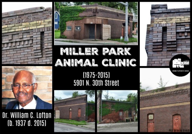
Sam Gendelman’s Fort Street Grocery Store was at 2771 Fort Street for more than 25 years. The Craddock Bicycle Shop ran at North 30th and Laurel for a decade before becoming a veterinarian office. There were offices crammed in near 30th and Ellison, with a grocery store and hair shop set along the street before the drive thru restaurants, bars, a drug store and a cafe once packing the corner of 30th and Fort.
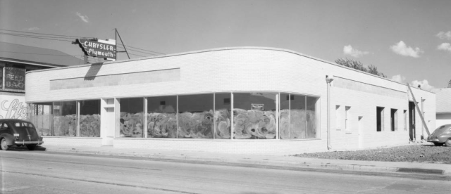
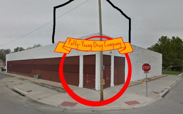
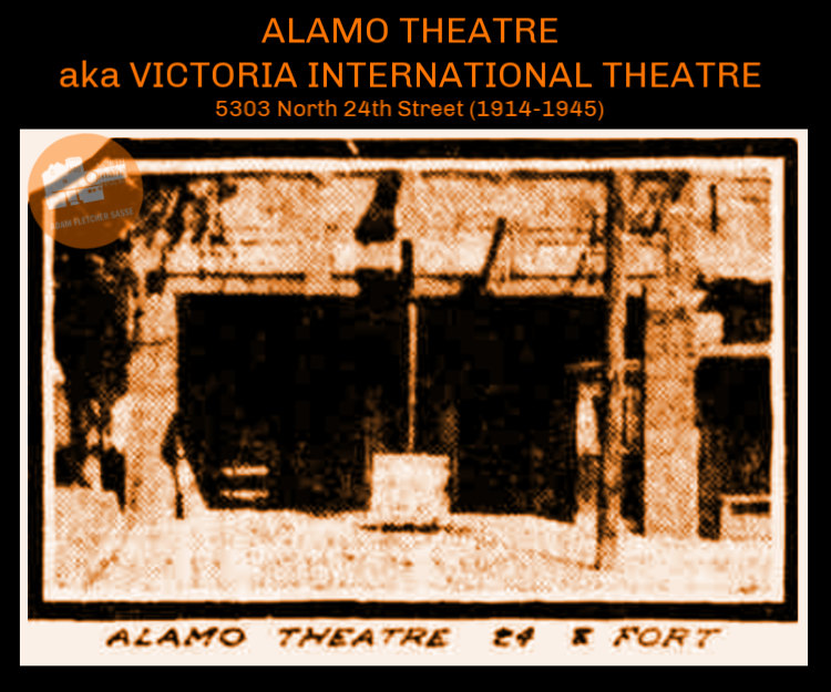
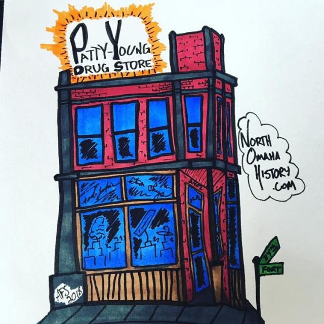
The intersection of 24th and Fort was once the hub of a thriving commercial district that included a large grocery store, dry cleaners, a drug store, a pharmacy and a bar. As early as 1914, the intersection was home to the Alamo Theatre, showing silent movies for that era. There were several grocery stores, including the Saratoga Grocery in the 1920s and a Baker’s in the 1950s and 60s. Steier Pharmacy was on the corner for 50 years before moving near N 72nd and Ames. As early as 1905, George Zimmer ran a floral shop at this intersection. A smaller grocery store called the Saratoga Food Store was located at 24th and Fort in the early 20th century.
In the 1980s and 90s, Jesse Irvin was a lawyer and counselor who kept an office on this corner. Mr. L ran his jitney service and hair salon here for a few decades, too. Another grocery store, called Miller Park Grocery, was located at 6339 North 24th Street, at the intersection of 24th and Redick Streets.
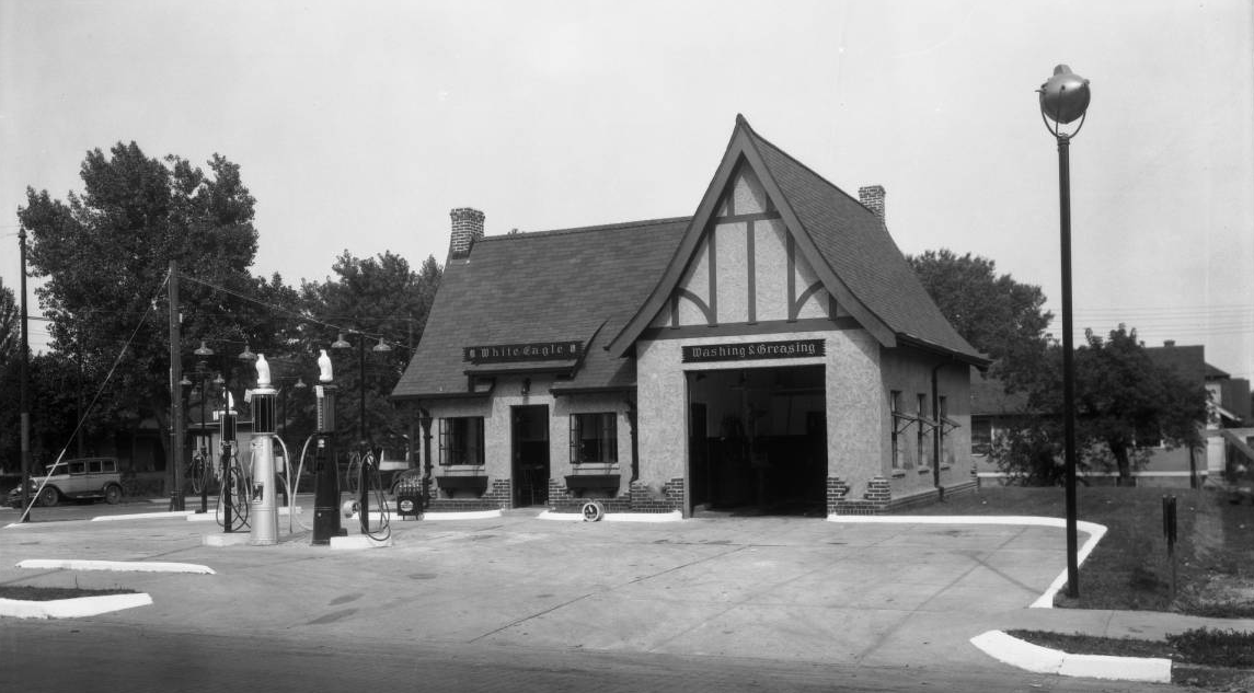
There were a variety of garages and gas stations throughout the neighborhood. In 1922, Fred S. Peterson built a garage at 24th and Laurel that still stands there today. The old Phillips 66 gas station at 5723 North 24th Street shows the reason why the neighborhood is important. Once typical in suburban landscapes across the United States 60 years ago, today this iconic building style has almost been completely erased from the nation’s map. Early on, a White Eagle Gas Station sat at N. 30th and Fort Streets.
A Commercial Federal Savings and Loan branch sat at 30th and Fort in the 1970s and 80s. It was eventually demolished and replaced by a Popeyes Chicken. At that same intersection was a Bronco’s Burger and the iconic Mister C’s (see below); Ju Jo’s Pub, and a carwash. A United Rentals was also located on that block.


Few people know that the Miller Park neighborhood once had two movie theaters operating at the same time. One was in Fort Omaha, and operated during World War II for soldiers and their dates from the neighborhood, while the other was called the Alamo Theater and later the Victoria International Theater. During WWII it showed international movies, and stayed open into the 1950s.
Social Life
The social life of any neighborhood reflects the people who live there, and people generally live in neighborhoods that reflect their social priorities.
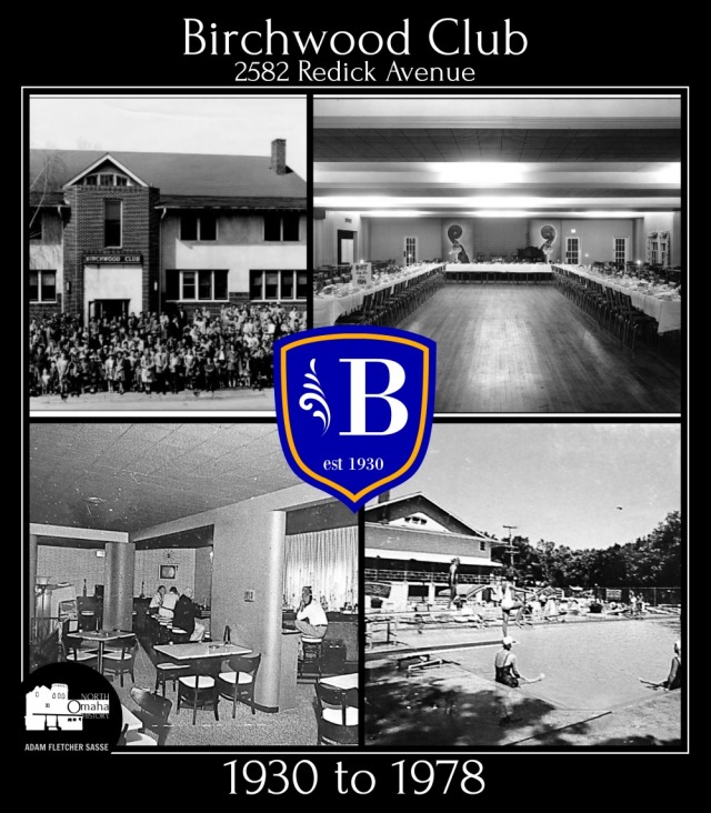
A building at the intersection of Redick Street and Minne Lusa Boulevard holds a storied, but yet untold, history that enlivens both the Miller Park and Minne Lusa neighborhoods. Built by the developer of the Minne Lusa neighborhood, it was originally called the Prettiest Mile Club in honor of its intersecting boulevard and was designed by popular Omaha architect Everett S. Dodds. The club was essentially a social hub with a restaurant, dance floor and bar. This building was a hotspot in North Omaha, drawing dances, card games, fraternal groups, socials and other activities through its doors in a constant stream of middle class bliss. Dan Desdunes and his band were among the performers that got people dancing there in the 1910s and 1920s. In 1930, the building changed hands and was renamed the Birchwood Club. The good times continued through the 1950s and into the 1960s. At some point, the building changed hands and was renovated extensively. Today it is known as the Viking Ship and is missing any historical charm. However, there are efforts to maintain its current appearance and recognize its historical value.
Restaurants dotted the neighborhood. From the 1890s through today, the intersection of North 30th and Fort has always been clogged with drug stores, groceries and places to eat, drink and recreate. Early on there were cafes there, particularly serving the US Army troops at Fort Omaha, as well as local residents.
These places weren’t always inclusive though. According to the Omaha World-Herald, a regiment of Black soldiers was stationed at Fort Omaha in 1931. White people in the Miller Park neighborhood protested a lot, writing letters to the newspaper and their elected officials. African American community leaders and politicians took it upon themselves to sound out loudly on behalf of the troops. Nebraska State Legislator John Singleton worked with Gene Thomas, a past commander of the Legion Post of Spanish War Veterans, and others to promote the inclusion of the troops there. The neighborhood eventually shut up.
The intersection changed with the times. The first Bronco’s Burgers restaurant was opened in 1959 by “Bronco Billy” Barnes. It was Omaha’s first locally owned and operated fast-food restaurant at a time when “fast-food” was an entirely new concept. Business was good. It was demolished and replaced by Sonic Drive-In in the late 1990s.
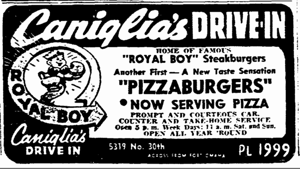
At the same intersection, in 1953, Sebastiano Caniglia bought a drive-in kitty-corner to Bronco’s. It was called Caniglia’s Royal Boy Drive-In, but Caniglia started adding sit-down seating in the 1950s and closed the drive-in portion in 1970. In 1971, he renamed the restaurant “Mister C’s”, which became his nickname, too. It closed in 2006.
Getting Around the Neighborhood

The Miller Park neighborhood is surrounded by major thoroughfares today. As mentioned earlier, North 30th and North 24th are arteries. North 30th carries US Highway 75 through the neighborhood, too. Immediately south, a commuter railroad line called the Belt Way was once a community boundary. It ran from downtown Omaha to this north end, and back south through the Adams Park neighborhood and around to downtown again.
The most famous feature of Miller Park’s transportation isn’t actually in the neighborhood. Dr. Miller succeeded in convincing the City of Omaha to build Omaha’s Prettiest Mile Boulevard to his namesake park the following year. In 1890, the roadway moved north to Reed Street, and later it became known as Florence Boulevard. In 1886, he failed to land the Trans-Mississippi Expo on his land.
It can be hard to imagine today, but when they were first laid out in the 1890s, the boulevards surrounding Miller Park were intended to serve as a loop roadway around the entire city of Omaha. Florence Boulevard was designed to and originally ran smoothly into Miller Park along the curvaceous Birch Drive. This flowing road connected to the Minne Lusa Boulevard, which would bring driving frolic-ers northbound past the Prettiest Mile Club and towards the old Blair Road. Birch Drive also connected with Belvedere Boulevard, wandering westward up the hill towards Fontenelle Boulevard and onward.
Streetcars
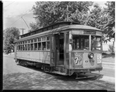
Because of its suburban relevance to the city, the neighborhood once had streetcars prowling its boundaries, too. The city’s private streetcars shot north along 24th Street, promptly heading south on the same street again after the line ended in the Minne Lusa neighborhood. The tracks leading into the neighborhood from the south on North 24th were double tracks. They were built to carry large passenger loads to Miller Park and Minne Lusa.
Streetcars also shot from North 30th along Fort Street to meet North 24th, creating a convenient loop that kept cars moving. The lines were removed when the cars were taken off-line in the 1950s. City-run buses soon took their places, and continue to operate today.
Transportation Today
In the 1950s, the State of Nebraska hosted an Interstate Highway planning commission to ensure the entire state’s interests were represented when designing the Interstate system. This commission came perilously close to demolishing the Miller Park neighborhood, as well as the Minne Lusa neighborhood and the Florence Water Works. Luckily, a gambit to save the massive Miller Park park paid off, and the highway that would’ve become the I-480/I-680 connector was only finished to present-day Sorenson Parkway.

When I was growing up in the 1980s, the North Expressway/Sorensen Parkway/Abbott Drive intersection was being installed just south of the neighborhood. It took over the old railroad bed from the Belt Way line, which was used by other railroads for 50 years. Today, buses serve North 30th and North 24th, and Fort Street.
The Miller Park neighborhood has paved sidewalks and curbs throughout, with paved streets in moderate to poor condition throughout the neighborhood. The streets are moderately wide through the neighborhoods, with wider stretches on Fort, North 24th and North 30th. There are intermittently placed light poles throughout the whole neighborhood.
A Neighborhood Struggling

In the 1940s, Omaha’s routine practice of redlining Near North Omaha was ruled illegal. By the 1960s, African Americans were moving north throughout the community, and eventually they moved into the Miller Park neighborhood. When my family moved there in the 1980s, we were among the few white families left. Most of the white kids I knew from late elementary school at Sherman had moved away by the time we went to McMillan Junior High, and I only remember two other white guys in my neighborhood who went to North High with me. I think only one of them graduated. White flight, driven by white privilege, sent families out of the neighborhood and towards west Omaha, where many still live. Others moved to Florence, while others moved to other areas of North Omaha that were less threatening to their sense of well-being.
But through the 1980s, the neighborhood wasn’t struggling. My neighbors took care of me, my life was filled with adults that cared, and there were a lot of places I could go whenever, however I wanted to. When I didn’t remember, I got jumped or had to run fast.
There was a distinct day in the summer of 1988 when my friends and I gathered at the corner of 28th and Fort Streets, midway between all of our houses. That day was hot and humid, and the street was mostly empty. As we gathered there, I remember we didn’t talk about any of that though. Instead, we talked about the nightly news from the days before, and how they were announcing the arrival of the Crips and Bloods into Omaha. I remember distinctly the cadence and urgency in their talking, and how these street gangs sounded like invading hordes.
Miller Park, and the rest of North Omaha, had gangs before the Crips and Bloods. The city was a bloody mess when Tom Dennison ran it from the 1890s through the 1920s, with gangland shootings, hunting mobs and racial lynchings. Through the 1950s and 60s, a crime syndicate with links to the old Chicago and New York City mafia operated in Omaha, operating the off-track-betting (OTB) and other illicit activities. The 1970s and 80s saw the Vice Lords, Black Gangster Disciples and other drug-focused gangs move into the city. But it all changed in the summer of 1988.
Early that year Houston Alexander was still leading the SCRIBBLE CREW, Run DMC and Koo Moe Dee were hard rappers, and everyone knew Sweet 98 was a pop joke radio station. But nobody was killing each other. A year later, dudes I was in the ninth grade with were dropping out to sell crack, girls I was in middle school with started having babies, and my brother had to go away from our neighborhood for a summer to keep from getting shot. That was the beginning of the neighborhood suffering.
During this same time, the City of Omaha began routinely neglecting Miller Park as it continued turning its back on the entirety of North Omaha. Police presence was for enforcement only, and emergency service response times became notoriously poor. Streets were allowed to crumble, and still are, and absentee landlords rule much of the neighborhood still. Housing prices are still ridiculously low, affected by poor quality sewer services and other urban infrastructure that’s being left to crumble by the City.
I was one of the few people in the neighborhood who graduated from high school on time. After struggling through working at a summer camp, a restaurant and a factory warehouse in East Omaha, the year I was 20 I left the neighborhood for good. I’d grown up in hard times, saw friends and acquaintances go through hard times, and I could choose to be done with the hard times. So I did.
Now, almost 20 years later, the neighborhood is still struggling.
A simple search over the Internet on any given day shows the city’s opinion about Miller Park and all of North Omaha is worse now than ever before. That search will also show dozens of articles about drive-bys, gun fights, drug deals, carjackings, and a plethora of other crap that still happens week in and out.
With no support from the City of Omaha for substantive redevelopment, the neighborhood is literally crumbling where it stands. Its clear that Omaha’s urban planners are pursuing a “Detroit Plan” for the vast majority of North Omaha: Let the majority of the housing stock and commercial infrastructure fall apart, bulldoze the rest eventually, and if/when the demand comes back, redevelop the area according to middle and upper class expectations. If its true, that’s an unfortunate route, to say the least, if only because of what I’ve illustrated thus far. But there’s more still.
Bright Spots in Miller Park Today

There are bright spots emerging in other parts of North Omaha. One of the brightest is featured in the graphic above: Mr. Gene Haynes, the principal of my alma mater, North High. Brother Haynes has ratcheted up the academic, athletic and cultural power of the school since taking the helm in the 90s. In turn, economic and political influence have followed. Today, North is experiencing a renaissance in and out, with new facilities, new championships, and new academic goals never met before.
In another part of North Omaha, after letting the north side of downtown Omaha rot for more than 40 years, the City of Omaha is successfully redeveloping the community with sports, entertainment, residential and commercial venues. The Near North Side neighborhood begins a long road of gentrifying to meet Creighton University’s demands. Like I mentioned, the Minne Lusa Historic District is a win, and it seems like the Florence neighborhood further north is beginning to get some legs in it’s growth. Florence Boulevard just hosted a very successful home tour last summer, and Metro Community College is building a new office building at the corner of 30th and Fort where the old Mister C’s restaurant closed almost a decade ago.

My dream for the Miller Park neighborhood is that its acknowledged for the high quality, architecturally rich housing stock in the neighborhood, along with the rich opportunities for education, recreation, spirituality and community. I want to see it become a historic district, with realized tax incentives for redevelopers who encourage home ownership among the people who live there now.
The brightest spots in the neighborhood though, those are where my heart is: the young people. The first job I ever fell in love with I got in the Miller Park neighborhood, working with Idu to use theater to teach children and youth about their personal power. Idu’s pioneering program, called “You’re the Star!”, changed my life and the lives of dozens of others. I want to work with people in the neighborhood to launch a new empowerment program that can change the lives of my kids, and the kids the whole neighborhood is raising. As always, they’re the ones who will change things for real, and the reason why I do any of this today.
My hope for the future of Miller Park, North Omaha, the Midwest, the United States and all the world remains with young people today and forevermore. Children and youth are our only hope; let’s act that way, starting now.
Tidbits
This is other information I found that didn’t fit into this article, but still relates to the neighborhood somehow. People had a variety of interests:
- In 1952 a man named Elmer Gerfen ran an amateur radio state there with the call letters WeQMX at 2824 Fort Street.
- People used to ice skate, play hockey and curl on the Miller Park Lake. There was an annual ice festival there for years.
- Driving instructors from Tech High would take their students to Miller Park to teach them how to drive in snow. One recollection from a former resident was sliding cookies in the park and learning how to steer out of them.
- In the 1930s, 40s and 50s, Ralph N. Perkins operated the Perkins Laboratories at 2584 Laurel Avenue. Apparently, his business provided chemist and engineer services as bacteriologists who specialized in the design or redesign of swimming pools. By the 1970s, Orson Perkins, presumably Ralph Perkin’s son, was the executive director of the Nebraska Mental Health Association. He lived in his father’s home.
Miller Park Neighborhood Directory

Here are all the interesting locations I tracked down to write this article. Some go back more than 100 years, and some are present-day. This would make a fine tour through Omaha’s Miller Park neighborhood!
- Fort Street Special School for Incorrigible Boys (1913-1918), N. 30th and Browne St.
- Miller Park Elementary School, Ellison Ave.
- Elmer Gerfen’s Amateur Radio Station WeQMX, 2824 Fort St.
- Mister C’s Restaurant site, N. 30th St. and Fort St.
- Bronco’s Restaurant site, N. 30th St. and Fort St.
- Prettiest Mile Club, aka Birchwood Club, aka The Viking Ship, Minne Lusa Blvd. and Redick Ave.
- Commercial Federal Savings and Loan, N. 30th St. and Fort St.
- Ju Jo’s Pub, N. 30th St. and Fort St.
- United Rentals, N. 30th St.
- Peterson’s Garage, N. 24th and Laurel – Still stands there today.
- Phillips 66 Gas Station, 5723 N. 24th St.
- Miller Park Grocery, 6339 N. 24th St.
- Saratoga Grocery and Meats, N. 24th and Fort St.
- Zimmer Flowers, N. 24th and Fort St.
- Baker’s Groceries, N. 24th and Fort St. – Later Safeway, then Phil’s Foodway.
- Alamo Theatre, N. 24th and Fort St. – A movie theater that was open in 1914.
- Grocery Store, 2702 Fort Street
- Pet Store, N 30th and Laurel Sts. – Later a veteranarian
- R and L’s Liquor Store, N 30th and Laurel Sts.
- Bicycle Shop, N 30th and Kansas Sts.
- Grocery Store, 5827 North 24th St.
- Blessed Sacrament Church, North 30th and Curtis Ave. – Founded in 1919, closed in 2014.
- Miller Park Presbyterian Church, North 30th and Huntington Ave.
- Second Advent COGIC, North 30th
- Power House COGIC, Browne Street and North 25th Ave.
- Tabernacle of Faith GOGIC, North 24th and Fort Sts.
- Gethsemane COGIC, North 24th and Himebaugh Ave.
- Christ-Love Unity Church, 29th and Ellison Ave.
- Mount Carmel Baptist Church, North 27th and Camden Ave.
- Pearl Memorial Methodist Episcopal Church, N. 24th and Ogden Ave.
- Episcopal Church of the Resurrection, N. 30th and Kansas Ave.
- Trinity Lutheran Church, N. 30th and Redick Sts.
- House, 2905 Ellison Avenue is a beautiful American foursquare with wide eves.
- House, 2717 Fort Street has interesting elements that are unique in North Omaha.
- Miller Park Duplex Historic District, North 27th Avenue from Laurel to Himebaugh Aves., wrapper around the corner onto Laurel – Distinct post-war multi-family homes sharing a unique central green space.
- House, 2589 Crown Pointe Ave.
- House, 2585 Crown Pointe – Notable for its size and distinctive features
- House, 2551 Crown Pointe Ave.
- House, 6011 North 24th St. – Beautiful for its simple stucco exterior,
- House, 2409 Crown Pointe Ave.
- House, 2417 Crown Pointe Ave.
- House, 5415 North 24th St.
- Apartments, 5711 North 24 St.
- Perkins House, 2584 Laurel Ave. – Once home to the Perkins Laboratory, it was also the office of the Nebraska Mental Health Association for a number of years.
- Florence Boulevard, Odgen Ave. to Reed St. – This specific section was once called “Omaha’s Prettiest Mile”.
- Minne Lusa Boulevard – Named in honor of Spanish Fur Trader Manuel Lisa, this beautiful drive covers a creek that flows from the Miller Park pond to the Missouri River.
- Birch Drive, N. 24th to N. 30th through Miller Park – Once regarded as a magnificent rural drive.
- Belevedre Boulevard – Winds up from Miller Park to the Belevedre Lookout, where Lewis and Clark may have stood and looked across the Missouri River valley.
- White Eagle Gas Station, N. 30th and Fort Streets
- Fort Omaha School (1888-1896), N. 30th and Browne Streets
You Might Like…
MY ARTICLES ABOUT THE MILLER PARK NEIGHBORHOOD: Miller Park | Miller Park Duplexes | 30th and Fort | 24th and Fort | Fort Street Grocery Store | 5901 North 30th Street | Pearl Memorial United Methodist Church | Mr. C’s | Fort Street Special School for Incorrigible Boys | Fort Omaha School | Fort Omaha | Fort Omaha Balloon School |
Related: 24th Street | Florence Boulevard
MY ARTICLES ABOUT HISTORIC NEIGHBORHOODS IN NORTH OMAHA
National Register of Historic Places Historic Districts in North Omaha: 24th and Lake Historic District | Benson Downtown Historic District | Country Club Historic District | Dundee/Happy Hollow Historic District | Fairacres Historic District | Fort Omaha Historic District | Minne Lusa Historic District | Nicholas Street Historic District
Historic Neighborhoods in North Omaha: Bedford Place | Belvedere Point | Bemis Park | Benson | Briggs | Bungalow City | Carter Lake, Iowa | Central Park | Clifton Hill | Collier Place | Creighton University | Crown Point | DeBolt | Druid Hill | East Omaha | Fairfax | Florence | Florence Field | Fort Omaha | Fontenelle View | Gifford Park | Gold Coast (Cathedral) | High Point | Jefferson Square | Kellom Heights | Kountze Place | Lakewood Gardens | Little Russia | Long School | Malcolm X Memorial | Miller Park | Miller Park Duplex Historic District | Monmouth Park | Montclair | Near North Side | North Downtown Omaha | Omaha View | Orchard Hill | Plum Nelly | Prettiest Mile in Omaha | Prospect Place | Raven Oaks | Redman | Saratoga | Sherman | Squatter’s Row | Sulphur Springs | Ponca Hills | Wakonda | Walnut Hill | Winspear Triangle | Wyman Heights
Lost Towns in North Omaha: Benson | Briggs | DeBolt | East Omaha | Florence | Saratoga | Sulphur Springs
Elsewhere Online
- Jim McKee (2012) Biography of Dr. George L. Miller, Lincoln Journal-Star
- Video tour of 2584 Perkins Avenue (1913) by CPM Omaha.
BONUS PICS!


Leave a comment