
The first boulevard in Omaha’s extensive system was it’s most spectacular for a long time. Extending from downtown Omaha along North 19th Street, it became North 20th Street and then, from Ames Avenue to J.J. Pershing Drive, became a hallowed place in history called “Omaha’s Prettiest Mile.” This is a history of Florence Boulevard in North Omaha.
A Dusty Road to Old Towns
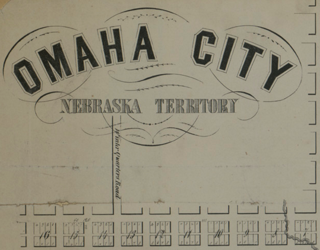
Before it took off, the little town of Omaha City had a northward route shooting out to another riverside city to the north. Originally called Winter Quarters Road, it became known as the Florence Road. Moving through the flat prairies on an area of land called a bench, Florence Road crossed the North Omaha Creek, went to the Kountze brothers’ land, past the boom-and-bust town of Saratoga, and onwards to Florence. It was originally a wagon road covered with dust and ruts, and while it was used a lot, it wasn’t the best ride in the area. A horse-drawn carriage could travel about 4 miles per hour, so it would take more than an hour to ride to today’s Florence neighborhood, a 10-minute car drive.
Between the 1850s and 1880s, that was the norm, until the late 1880s when it changed.
A Nationally Famous Designer Is Hired
For decades, Florence Boulevard was Omaha’s first and finest parkway. Standing at the corner of Cuming Street and Florence Boulevard in the Near North Side, it’s hard to imagine this straight-laced ribbon of pavement was ever called “Omaha’s Prettiest Mile Boulevard” and “Omaha’s Most Beautiful Mile”, and was lined with flowers, fine buildings, and special events from downtown all the way to Read Street where it ends. But that is the case.
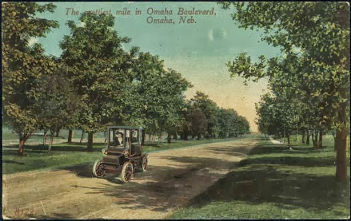
Designed by nationally-renowned landscape architect Horace Cleveland, Omaha’s Prettiest Mile got it’s original name in 1892. Created for leisurely carriage rides northwards to a beautiful district of homes, it was straight and wide, with a median running its entirety, and the first street lamps in the city lighting the way. Eventually renamed for the town near it’s northern terminus, the boulevard runs along the top of a long cliff for much of it’s route.
A Founding Father’s Niece

Named after Florence Kilborn, the niece of James C. Mitchell, who organized the Florence Land Company in 1854, the town of Florence was at the north end of Florence Boulevard. However, before the Town of Florence was named as such, it was originally settled in 1846 and built up as Winter Quarters. That’s why the road that became Florence Boulevard was originally called Winter Quarters Road, as evidenced by the cutaway image from an 1856 map.
Winter Quarters Road originally ran through the Parker Farm, established in 1860 by Florence pioneer James Monroe Parker. Parker was a banker and real estate mogul, and his family left an indelible mark on Omaha that is still visible today. Part of the Parker Tract – an 80-acre chunk of land south of Florence – became Miller Park. The other part became the Minne Lusa and Florence Field neighborhoods.
Designed to be a beautiful drive out to Omaha’s new Miller Park, it featured glorious views from the hundred foot cliffs that leaped up from the flats laying west of the Missouri River. First by carriage, horse, and bicycle, Florence Boulevard later became popular with early car drivers.
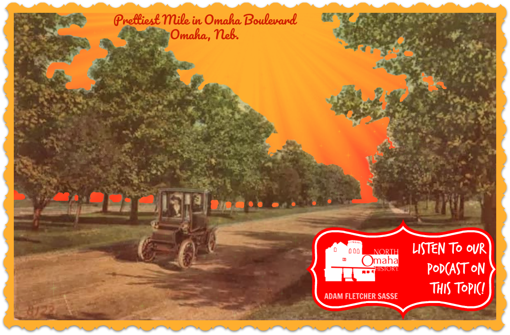
Tall cottonwood, willow, ash and elm trees along the boulevard looked over the river bed’s red oak, hickory, hophornbeam and redbud trees. Attractive homes and elaborately flowered medians lined the length nearest to Miller Park, and the boulevard became known as “The Prettiest Mile”. The boulevard was smooth and level, and without street car rail tracks crisscrossing it, it was no wonder that Florence Boulevard was also called “the only suitable driveway in Omaha.”
More Than A Street
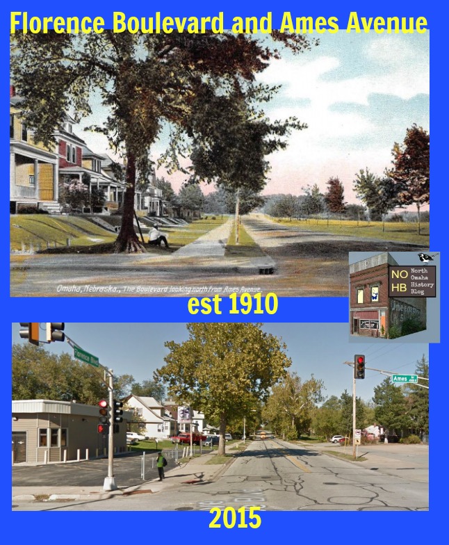
The city started building Florence Boulevard in October of 1892, from Ames Avenue to just north of Kansas Street. The boulevard anticipated the construction of Miller Park. Within the next decade, a road between Chicago and Ames Streets was improved with landscaping and added to the boulevard. In 1897, the Omaha Park Commission took authority of the boulevard. It was named Florence Boulevard that year.

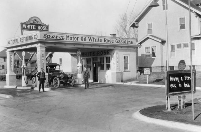
In 1912, Omaha spent $6,000 to maintain Florence Boulevard. Starting at N. 19th and Chicago Streets, at this point the Boulevard went west to N. 20th Street, north to Ames Avenue, and onward to Miller Park. Around that year, Florence Boulevard was the first roadway in Omaha to be fully lit with electric lamps.
Along the boulevard, there are four parks and a lot of historical places. The Trans-Mississippi Exposition was located on the spot of the modern Kountze Park. Cliff View Park looked over East Omaha and the Missouri River. Miller Park, with its beautiful lagoon, was located at the north end of the boulevard.
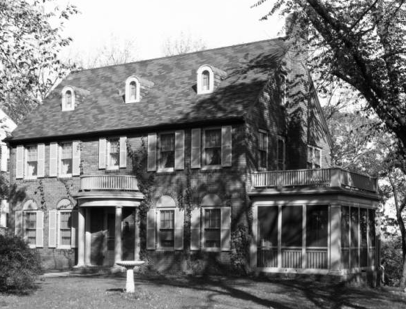
There is at least one house along Florence Boulevard that’s much older than the boulevard. Built in 1869, the Fort Omaha House is located at 6327 Florence Boulevard. It was moved to the boulevard in 1890.

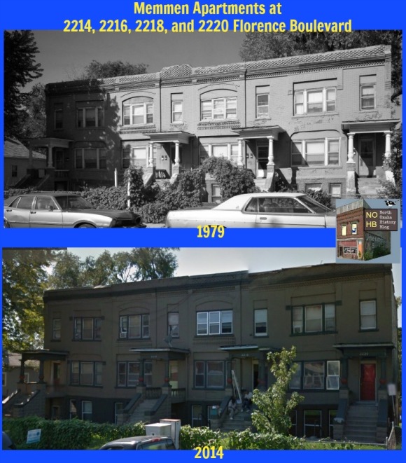
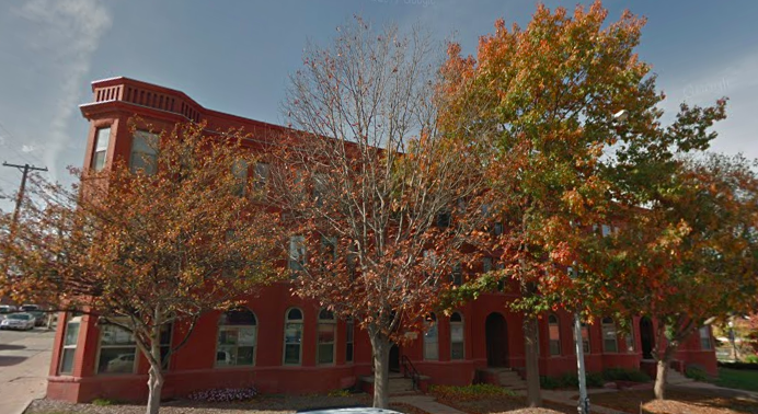
Other historical places along the boulevard include the George H. Kelly House at the intersection of Wirt Street and Florence Boulevard. It had been recognized by the City as an official Omaha Landmark. The Broadview Hotel at 2060 Florence Boulevard was built in stone reflecting the English Scottish Baronial Revival architecture. It features crow-stepped gables, crenellations, and a small turret. It served as a Black hotel for at least 50 years. The Memmen Apartments, at 2222 Florence Boulevard, were built in 1889 and still reflect a magnificent commitment to strong architecture in Omaha. For fifty years, the Omaha Presbyterian Theological Seminary sat calmly along the boulevard at Emmet Street.


The boulevard also had its share of sports facilities too. The Kountze Place Golf Club was located at Florence Boulevard and Emmet Street, and was a nine hole course that was organized in 1899 and lasted for just two years, through 1901. Nearby was the Kountze Place baseball grounds, which included a large grandstand and well-kept field between Miami Street and Locust Street. It operated from the 1880s through the 1890s.
Parkwood and Norwood Additions
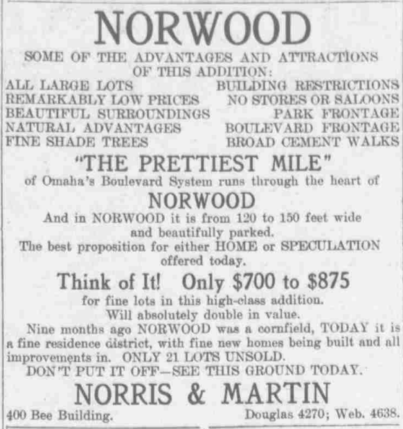
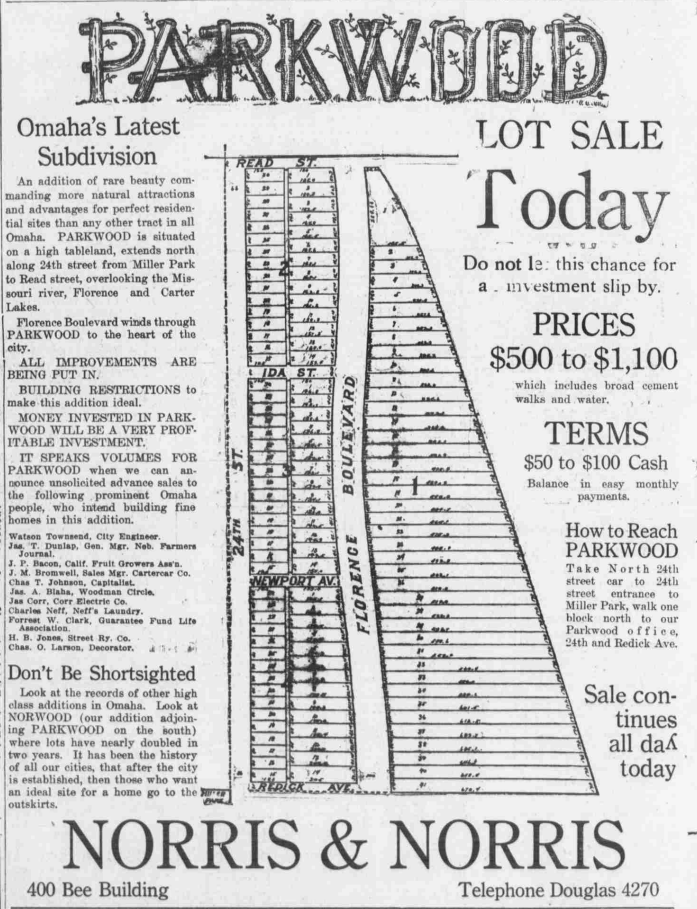
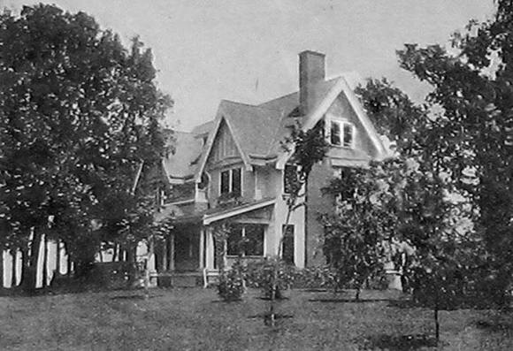
The Parkwood and Norwood Additions along Florence Boulevard north of Ames Avenue are one of the most highly-regarded places in North Omaha. More than a two dozen particularly beautiful homes designed by architects in several distinct styles line the distance northward. There are Colonial revival, Second Spanish revival, Neo-Classical, Tudor revival, and many other era-specific revival style homes, as well as American Foursquare and Arts and Crafts movement homes.
Parkwood and Norwood are separate subdivisions along this northern section. Norwood extends from Ogden Avenue to Redick Street, and Parkwood goes from Redick to Reed. Norwood was developed first, then Parkwood. The ad for Parkwood above mentions this at the bottom of the graphic.
There are medians separating the boulevard from Ogden Avenue northward to Redick, then the roadway is shared to Reed. The medians are manicured places, with wonderful trees and flower beds still in some locations along the way.

Today, there is a movement in Omaha to renew Omaha’s boulevard system. Here’s hoping they’re successful, and that they don’t neglect the North Omaha components of the system, including Florence Boulevard!
The Tunnels of Florence Boulevard
I try to base everything in this blog on sources of some type that can be confirmed and accessed by other people. However, I believe there’s a role for storytelling.
That said, I have not found any official information to corroborate what I’m going to share here. However, since I was a teenager growing up near the Florence Boulevard’s most northern section, there have been stories and rumors and conjectures about the tunnels of Florence Boulevard.
Most often, the story says that on the east side of Florence Boulevard there are several old houses that have tunnels beneath them. There are a few stories about why they’re there:
- Livery stables: Built in more dainty times, homeowners along the Boulevard had tunnels made to allow their horses to stay warm and their bodies not to get cold going outside. There are supposedly small rooms along the tunnels for storing grain and tack.
- Moonshining: During Prohibition, several of the homes along Florence Boulevard were used for running illegal liquor. Moonshiners used the small storage rooms for their stills, and dump their mash into a little creek that ran at the bottom of the cliff. That creek ran into a pond at the bottom of Horseshoe Bend, and as the story goes, “the feds knew there were stills upstream because the fish in that pond were huge.”
- Partying: During the Roaring Twenties, svelte upperclass parties were held in the fields at the base of the cliff. On warm summer nights, party goers would roam down the tunnels and into the fields, where bright incandescent bulbs would light a mowed patch of grass, and the swirls of old-fashioneds and other illegal booze. A phonograph or radio would crank out rags while fancy men and pretty ladies would party away the evenings.
- More Parties: Later, in the 1950s and 60s, wayward souls would sneak into the tunnels. More than once, a fire was started that would smoke out the houses above, so most of the tunnels were sealed.
According to one account, most of the tunnels had concrete walls, with at least one that had dirt walls. There were old style electric lines for lights along the walls, and a lot of names and dates carved in the walls with dates from the 1920s and 30s.
There are other stories about sinkholes opening up in the driveways along Florence Boulevard, revealing hidden rooms and tunnels. One home had a spectacular sunroom that revealed copper piping for no reason, and when pursued they led to a false wall with a room behind it. Another former homeowner along the Boulevard talked about bricked-over doorways in the basement and old electrical lines heading east out of the basement towards what they thought was nothing.
In my own experience, when I was young my dad used to take us on night hikes into the fields below the cliffs. We’d roam through the woods and tall grasses there in the night and check out the creepy things, mostly by moonlight. There were two barns and an old military halftrack vehicle down there, along with some dead cars and stuff. One night we found a tunnel behind some boards, and we let ourselves in. Over the next several years, we went back there a few times, each one going further into the scary abyss. One day we got there and it was boarded up tight, and we never came back again. Its hard to say whether the tunnels along Florence Boulevard have all the heritage these stories imply. They might have been utility tunnels; they might have been frivolous; they might have been nefarious; they might have been all this. But they were there.
If you have any stories about the tunnels—or better still, photos—please share them with me.
Modern Times on Florence Blvd
As it was designed by Cleveland, Florence Boulevard was part of a grandiose boulevard system that ran throughout north and south Omaha. Unfortunately, Omaha’s civic leaders lost their vision for those boulevards, and it shows. The boulevard system remains today, although minus the park-like setting for the majority of its length. The last remainder of landscaping along Florence Boulevard remains from Ogden Avenue north to Reed Street.
The Garden Homes Apartments were built in 1949 by the Omaha Housing Authority with funds from the federal government. Located along Florence Boulevard between Emmet and Spencer Streets, and they were designed by Leo Dworak and built by Carl C. Wilson, Inc. There were originally 100 units there. In 1980, they were renovated and turned into the privately-owned Horizon Townhomes, and continue standing right now.
A Tour of Florence Boulevard
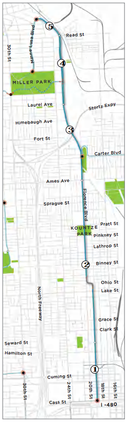
For the sake of this historic survey, there are three sections of Florence Boulevard in Omaha. The first part is in North Downtown Omaha and extends from Cass Street to Cuming Street. The second part spans from Cuming Street to Ames Avenue. The third part goes from Ames Avenue to Read Street.
First Section
- North Downtown Neighborhood History
- Thomas Brennan Tenements aka Campion House, 514 Florence Boulevard
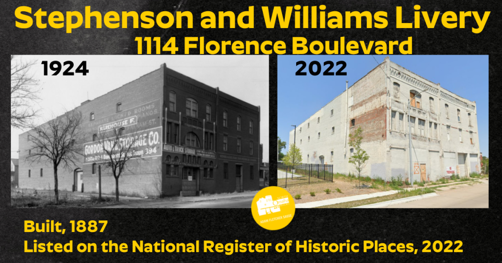
- Stephenson and Williams Livery, 1114 Florence Boulevard
Second Section
- Near North Side Neighborhood History
- The Broadview Hotel, 2060 Florence Boulevard
- Memmen Apartments, 2214, 2216, 2218, and 2220 Florence Boulevard
- Becks House, 2250 Florence Boulevard
- Former Lake School, Florence Boulevard and Willis Avenue
- Boulevard Tea Room, 2919 Florence Boulevard
- Kountze Place Neighborhood History
- George H. Kelly House, 1924 Binney Street
- Site of the Trans-Mississippi and International Exposition, Florence Boulevard and Pratt Street
- Site of Omaha Presbyterian Theological Seminary, 3303 North 21st Street
- Kountze Park, Florence Boulevard and Miami Street
- Kountze Place Golf Course, Florence Boulevard and Emmett Street
- Kountze Place Baseball Field, Florence Boulevard and Miami Street
- Horizon Townhomes, Florence Boulevard and Spencer Streets
- Horace Mann Junior High aka King Science Center, 3720 Florence Boulevard
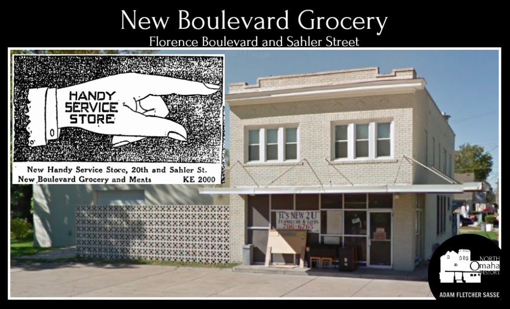
- Boulevard Grocery Store, 4123 Florence Boulevard
- Saratoga Neighborhood History
- Former Prettiest Mile Motor Company Building, 4225 Florence Boulevard
- Former Rullman Vacuum Washer Company Building, 4228 Florence Boulevard
- Site of the Omaha Motor Car Company Factory, 4311 Florence Boulevard
- Site of the Stroud Company Factory, 4311 Florence Boulevard
- Kelco Economette Company, 4401 Florence Boulevard
- Former Imperial Sash and Door Company Building, 4402 Florence Boulevard
- Former Weaver Pres-Kloth Company Building, 4426 Florence Boulevard
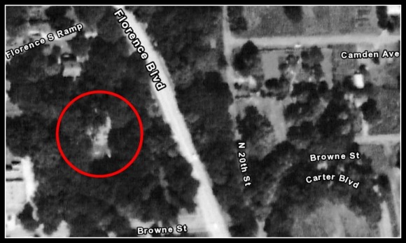
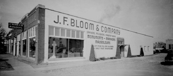
- Former J.F. Bloom & Company Building, 4435 Florence Boulevard
Third Section
- McGranahan / Gillette House, 4802 Florence Boulevard
- John / Charles Martin House, 4811 Florence Boulevard
- Rome Miller Mansion, 4823 Florence Boulevard
- Site of Stroud Mansion, Browne Street and Florence Boulevard
- Miller Park Neighborhood History
- Miller Park, Florence Boulevard and 24th Street
- 5216 Florence Boulevard
- Burke / Wood House, 6129 Florence Boulevard
- Gustafson/Gnader House, 6140 Florence Boulevard
- Brenner/Dennison House, 6141 Florence Boulevard
- Ruyf House, 6531 Florence Boulevard
- Westbrook House, 6532 Florence Boulevard
- Fort Omaha House, 6327 Florence Boulevard
- Litz House, 6453 Florence Boulevard
You Might Like…
- A History of 5815 Florence Boulevard in North Omaha
- A History of 4225 Florence Boulevard in North Omaha
- A History of 6327 Florence Boulevard in North Omaha
- A History of 4402 Florence Boulevard in North Omaha
- A History of 4426 Florence Boulevard in North Omaha
- A History of 5833 Florence Boulevard
- A History of the Rome Miller Mansion
- A History of the Stroud Mansion in North Omaha
- The Lost Monument by Michele Wyman
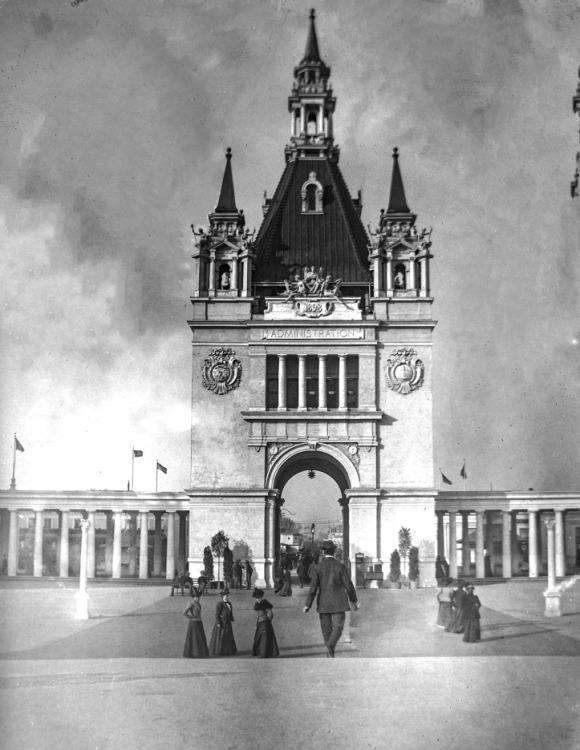
- A History of the Administration Arch in North Omaha
MY ARTICLES ABOUT THE HISTORY OF FLORENCE
Public Places: Florence Main Street | Florence Ferry | Florence High School | The Mormon Tree | Florence Water Works | Mormon Bridge | Florence Boulevard | River Drive | J.J. Pershing Drive and Monument | Potter’s Field
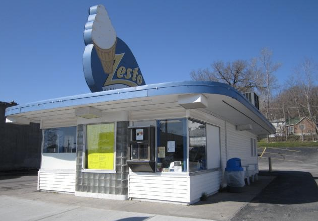
Businesses: Bank of Florence | Florence Mill | Zesto
Houses: Parker Mansion | Brandeis Country Home | Lantry-Thompson Mansion | Mitchell House | Hunt Mansion
Other Historic Places: Vennelyst Park | Florence Depot | Florence Home | Florence Building
People: James M. Parker | James Comey Mitchell | Florence Kilborn
Neighborhoods: Winter Quarters | Florence Field | Wyman Heights | High Point
Other: Directory of Florence Historic Places
MY ARTICLES ABOUT THE MILLER PARK NEIGHBORHOOD: Miller Park | Miller Park Duplexes | 30th and Fort | 24th and Fort | Fort Street Grocery Store | 5901 North 30th Street | Pearl Memorial United Methodist Church | Mr. C’s | Fort Street Special School for Incorrigible Boys | Fort Omaha School | Fort Omaha | Fort Omaha Balloon School |
Related: 24th Street | Florence Boulevard
MY ARTICLES ABOUT THE HISTORY OF KOUNTZE PLACE
General: Kountze Place | Kountze Park | North 16th Street | North 24th Street | Florence Boulevard | Wirt Street | Emmet Street | Binney Street | 16th and Locust Historic District
Houses: Charles Storz House | Anna Wilson’s Mansion | McCreary Mansion | McLain Mansion | Redick Mansion | John E. Reagan House | George F. Shepard House | Burdick House | 3210 North 21st Street | 1922 Wirt Street | University Apartments
Churches: First UPC/Faith Temple COGIC | St. Paul Lutheran Church | Hartford Memorial UBC/Rising Star Baptist Church | Immanuel Baptist Church | Calvin Memorial Presbyterian Church | Omaha Presbyterian Theological Seminary | Trinity Methodist Episcopal | Mount Vernon Missionary Baptist Church |
Education: Omaha University | Presbyterian Theological Seminary | Lothrop Elementary School | Horace Mann Junior High
Hospitals: Salvation Army Hospital | Swedish Hospital | Kountze Place Hospital
Events: Trans-Mississippi and International Exposition | Greater America Exposition | Riots
Businesses: Hash House | 3006 Building | Grand Theater | 2936 North 24th Street | Corby Theater
Listen to the North Omaha History Podcast show #4 about the history of the Kountze Place neighborhood »
MY ARTICLES ABOUT HISTORIC NEIGHBORHOODS IN NORTH OMAHA
National Register of Historic Places Historic Districts in North Omaha: 24th and Lake Historic District | Benson Downtown Historic District | Country Club Historic District | Dundee/Happy Hollow Historic District | Fairacres Historic District | Fort Omaha Historic District | Minne Lusa Historic District | Nicholas Street Historic District
Historic Neighborhoods in North Omaha: Bedford Place | Belvedere Point | Bemis Park | Benson | Briggs | Bungalow City | Carter Lake, Iowa | Central Park | Clifton Hill | Collier Place | Creighton University | Crown Point | DeBolt | Druid Hill | East Omaha | Fairfax | Florence | Florence Field | Fort Omaha | Fontenelle View | Gifford Park | Gold Coast (Cathedral) | High Point | Jefferson Square | Kellom Heights | Kountze Place | Lakewood Gardens | Little Russia | Long School | Malcolm X Memorial | Miller Park | Miller Park Duplex Historic District | Monmouth Park | Montclair | Near North Side | North Downtown Omaha | Omaha View | Orchard Hill | Plum Nelly | Prettiest Mile in Omaha | Prospect Place | Raven Oaks | Redman | Saratoga | Sherman | Squatter’s Row | Sulphur Springs | Ponca Hills | Wakonda | Walnut Hill | Winspear Triangle | Wyman Heights
Lost Towns in North Omaha: Benson | Briggs | DeBolt | East Omaha | Florence | Saratoga | Sulphur Springs
Elsewhere Online
- Podcast Show #17: Florence Boulevard: Escape the humid nights, humming locusts (cicadas), lazy lightning bugs and swelling thunderstorms of summertime in Omaha by going for a cruise along historical Florence Boulevard in this North Omaha History show!
- “The story of the bizarre (bootlegging?) tunnels beneath Omaha’s Florence neighborhood,” Chris Peters (July 11, 2016) for the Omaha World-Herald.
- “Get to know Florence Boulevard and Kountze Park,” Omaha By Design
- The Florence Boulevard Neighborhood Tour, Kristine Tynan Gerber (2015) for Restoration Exchange Omaha. It features homes north of Ames Avenue.
BONUS IMAGES!


Leave a comment